Şirrīn ash Shamālīyah geodata
Şirrīn ash Shamālīyah (Aleppo) is a seat of a third-order administrative division; located in Syria in Asia/Damascus (GMT+3) time zone. In our database, there are 87 cities with bigger population. Compared to other cities in Syria, 92.6% of cities are located further ↓South; 85.5% of cities are located further ←West and 70.7% of cities have higher elevation than Şirrīn ash Shamālīyah. Note1
Current local time in Şirrīn ash Shamālīyah:
01:51 PM, WednesdayDifference from your time zone: hours


Şirrīn ash Shamālīyah GPS coordinates[2]
36° 35' 18.168" North, 38° 17' 52.368" East
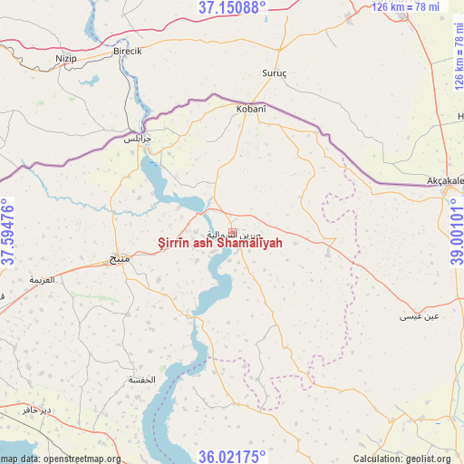
| Map corner | latitude | longitude |
|---|---|---|
| Upper-left | 37.15088°, | 37.59476° |
| Center: | 36.58838°, | 38.29788° |
| Lower-right: | 36.02175°, | 39.00101° |
| Map W x H: | 125.5×125.5 km | = 78×78mi |
| max Lat: | 37.17701° ⇑7.4% North |
| Şirrīn ash Shamālīyah: | 36.58838° |
| min Lat: | ⇓92.6% South 32.39332° |
| min Long | Şirrīn ash Sh | max Long |
| 35.75572° | 38.29788° | 42.14006° |
| W 85.5%⇐ | ⇒14.5% E |
Elevation
Elevation of Şirrīn ash Shamālīyah is 353 m = 1158 ft, and this is 176.1 m = 578 ft below average elevation for this country.
| Max E: |
1640 m = 5381 ft | 70.7% |
| Avg. | 529.1 m = 1736 ft | |
| Şirrīn ash Shamālīyah | 353 m = 1158 ft | |
Min E: |
4 m = 13 ft | 29.3% |
See also: Syria elevation on elevation.city.
Geographical zone
Şirrīn ash Shamālīyah is located in North temperate zone (between Tropic of Cancer and the Arctic Circle). Distance of this Northern Tropic circle is 1462.3 km =908.6 mi to South.| Distance of | km | miles | from Şirrīn ash Shamālīyah |
|---|---|---|---|
| North Pole | 5938.8 | 3690.2 | to North |
| Arctic Circle | 3332.9 | 2071 | to North |
| Tropic Cancer | 1462.3 | 908.6 | to South |
| Equator | 4068.2 | 2527.9 | to South |


Nearby cities:
15 places around Şirrīn ash Shamālīyah: (largest is in red/bold)
• Abū Qalqal
23.1 km =14.4 mi,  223°
223°
• Al Ghandūrah
51.2 km =31.8 mi,  280°
280°
• Al Jarnīyah
47.9 km =29.8 mi,  186°
186°
• Al Khafsah
46.8 km =29.1 mi,  211°
211°
• Al ‘Arīmah
53.1 km =33 mi,  256°
256°
• Dayr Ḩāfir
71.4 km =44.4 mi,  227°
227°
• Jarābulus
36.1 km =22.4 mi,  314°
314°
• Manbij
31.4 km =19.5 mi, 257°
• Maskanah
72.9 km =45.3 mi,  198°
198°
• Rasm al Ḩarmal
64.6 km =40.1 mi, 233°
• Shuyūkh Taḩtānī
26.7 km =16.6 mi, 312°
• Tall Abyaḑ
59.7 km =37.1 mi,  78°
78°
• Tādif
73.6 km =45.7 mi,  248°
248°
• ‘Ayn al ‘Arab
34 km =21.1 mi,  8°
8°
• ‘Ayn ‘Īsá
55.3 km =34.4 mi,  114°
114°
Sources, notices
• [Note1] Compared only with cities in Syria existing in our database
• [Src1] Map data: © OpenStreetMap contributors (CC-BY-SA)
• [Src2] Other city data from geonames.org with taken over terms of usage.
• [Src3] Geographical zone / Annual Mean Temperature by Robert A. Rohde @ Wikipedia
