Jarābulus geodata
Jarābulus (Aleppo) is a seat of a second-order administrative division; located in Syria in Asia/Damascus (GMT+3) time zone. With population of 24,997 people, there are 62 cities with bigger population in this country. Compared to other cities in Syria, 97.2% of cities are located further ↓South; 83% of cities are located further ←West and 69.3% of cities have higher elevation than Jarābulus. Note1


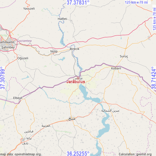
Jarābulus GPS coordinates[2]
36° 49' 3" North, 38° 0' 39.996" East
| Map corner | latitude | longitude |
|---|---|---|
| Upper-left | 37.37831°, | 37.30799° |
| Center: | 36.8175°, | 38.01111° |
| Lower-right: | 36.25255°, | 38.71424° |
| Map W x H: | 125.2×125.2 km | = 77.8×77.8mi |
| max Lat: | 37.17701° ⇑2.8% North |
| Jarābulus: | 36.8175° |
| min Lat: | ⇓97.2% South 32.39332° |
| min Long | Jarābulus | max Long |
| 35.75572° | 38.01111° | 42.14006° |
| W 83%⇐ | ⇒17% E |
Elevation
Elevation of Jarābulus is 356 m = 1168 ft, and this is 173.1 m = 568 ft below average elevation for this country.
| Max E: |
1640 m = 5381 ft | 69.3% |
| Avg. | 529.1 m = 1736 ft | |
| Jarābulus | 356 m = 1168 ft | |
Min E: |
4 m = 13 ft | 30.7% |
See also: Syria elevation on elevation.city.
Geographical zone
Jarābulus is located in North temperate zone (between Tropic of Cancer and the Arctic Circle). Distance of this Northern Tropic circle is 1487.8 km =924.5 mi to South.| Distance of | km | miles | from Jarābulus |
|---|---|---|---|
| North Pole | 5913.3 | 3674.4 | to North |
| Arctic Circle | 3307.5 | 2055.2 | to North |
| Tropic Cancer | 1487.8 | 924.5 | to South |
| Equator | 4093.7 | 2543.7 | to South |


Nearby cities:
15 places around Jarābulus: (largest is in red/bold)
• Abū Qalqal
43.3 km =26.9 mi,  167°
167°
• Akhtarīn
69.2 km =43 mi,  240°
240°
• Al Bāb
66.5 km =41.3 mi,  221°
221°
• Al Ghandūrah
29.8 km =18.5 mi, 236°
• Al Jarnīyah
75.7 km =47 mi,  164°
164°
• Al Khafsah
65.2 km =40.5 mi,  179°
179°
• Al ‘Arīmah
46.2 km =28.7 mi,  214°
214°
• Manbij
32.6 km =20.3 mi,  188°
188°
• Rasm al Ḩarmal
68.9 km =42.8 mi,  202°
202°
• Shuyūkh Taḩtānī
9.5 km =5.9 mi,  141°
141°
• Tchoban Bey
55.2 km =34.3 mi,  245°
245°
• Tādif
67.5 km =41.9 mi, 219°
• Şirrīn ash Shamālīyah
36.1 km =22.4 mi,  134°
134°
• Şūrān
76.5 km =47.5 mi, 248°
• ‘Ayn al ‘Arab
31.5 km =19.6 mi,  74°
74°
Sources, notices
• [Note1] Compared only with cities in Syria existing in our database
• [Src1] Map data: © OpenStreetMap contributors (CC-BY-SA)
• [Src2] Other city data from geonames.org with taken over terms of usage.
• [Src3] Geographical zone / Annual Mean Temperature by Robert A. Rohde @ Wikipedia
