Ma‘lūlā geodata
Ma‘lūlā (Rif-dimashq) is a seat of a third-order administrative division; located in Syria in Asia/Damascus (GMT+3) time zone. With population of 5,000 people, there are 83 cities with bigger population in this country. Compared to other cities in Syria, 75.6% of cities are located further ↑North; 53.7% of cities are located further →East and 98.9% of cities have lower elevation than Ma‘lūlā. Note1


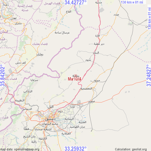
Ma‘lūlā GPS coordinates[2]
33° 50' 43.044" North, 36° 32' 42.504" East
| Map corner | latitude | longitude |
|---|---|---|
| Upper-left | 34.42727°, | 35.84202° |
| Center: | 33.84529°, | 36.54514° |
| Lower-right: | 33.25932°, | 37.24827° |
| Map W x H: | 129.9×129.9 km | = 80.7×80.7mi |
| max Lat: | 37.17701° ⇑75.6% North |
| Ma‘lūlā: | 33.84529° |
| min Lat: | ⇓24.4% South 32.39332° |
| min Long | Ma‘lūlā | max Long |
| 35.75572° | 36.54514° | 42.14006° |
| W 46.3%⇐ | ⇒53.7% E |
Elevation
Elevation of Ma‘lūlā is 1426 m = 4678 ft, and this is 896.9 m = 2943 ft above average elevation for this country.
| Max E: |
1640 m = 5381 ft | 1.1% |
| Ma‘lūlā | 1426 m 4678 ft | |
| Avg. | 529.1 m = 1736 ft | |
Min E: |
4 m = 13 ft | 98.9% |
See also: Syria elevation on elevation.city.
Geographical zone
Ma‘lūlā is located in North temperate zone (between Tropic of Cancer and the Arctic Circle). Distance of this Northern Tropic circle is 1157.3 km =719.1 mi to South.| Distance of | km | miles | from Ma‘lūlā |
|---|---|---|---|
| North Pole | 6243.8 | 3879.7 | to North |
| Arctic Circle | 3637.9 | 2260.5 | to North |
| Tropic Cancer | 1157.3 | 719.1 | to South |
| Equator | 3763.2 | 2338.3 | to South |


Nearby cities:
15 places around Ma‘lūlā: (largest is in red/bold)
• Al Quţayfah
12.9 km =8 mi,  156°
156°
• An Nabk
26.1 km =16.2 mi,  40°
40°
• An Nashābīyah
37.6 km =23.4 mi,  188°
188°
• Ar Ruḩaybah
18.5 km =11.5 mi,  127°
127°
• At Tall
33.9 km =21.1 mi,  219°
219°
• Aḑ Ḑumayr
26.3 km =16.3 mi,  148°
148°
• Dayr ‘Aţīyah
34.6 km =21.5 mi, 36°
• Douma
33.1 km =20.6 mi,  203°
203°
• Jayrūd
18.4 km =11.4 mi,  103°
103°
• Rankūs
17.6 km =10.9 mi,  235°
235°
• Sirghāyā
36 km =22.4 mi,  263°
263°
• Yabrūd
17.2 km =10.7 mi, 36°
• Şaydnāyā
23.2 km =14.4 mi, 223°
• Ḩarastā
36 km =22.4 mi,  207°
207°
• ‘Assāl al Ward
12.3 km =7.6 mi,  280°
280°
Sources, notices
• [Note1] Compared only with cities in Syria existing in our database
• [Src1] Map data: © OpenStreetMap contributors (CC-BY-SA)
• [Src2] Other city data from geonames.org with taken over terms of usage.
• [Src3] Geographical zone / Annual Mean Temperature by Robert A. Rohde @ Wikipedia
