Ḩārim geodata
Ḩārim (Idlib) is a seat of a second-order administrative division; located in Syria in Asia/Damascus (GMT+3) time zone. In our database, there are 87 cities with bigger population. Compared to other cities in Syria, 83% of cities are located further ↓South; 54.4% of cities are located further →East and 94.7% of cities have higher elevation than Ḩārim. Note1


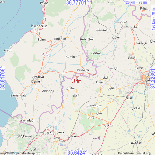
Ḩārim GPS coordinates[2]
36° 12' 42.336" North, 36° 31' 14.808" East
| Map corner | latitude | longitude |
|---|---|---|
| Upper-left | 36.77701°, | 35.81766° |
| Center: | 36.21176°, | 36.52078° |
| Lower-right: | 35.6424°, | 37.22391° |
| Map W x H: | 126.2×126.2 km | = 78.4×78.4mi |
| max Lat: | 37.17701° ⇑17% North |
| Ḩārim: | 36.21176° |
| min Lat: | ⇓83% South 32.39332° |
| min Long | Ḩārim | max Long |
| 35.75572° | 36.52078° | 42.14006° |
| W 45.6%⇐ | ⇒54.4% E |
Elevation
Elevation of Ḩārim is 173 m = 568 ft, and this is 356.1 m = 1168 ft below average elevation for this country.
| Max E: |
1640 m = 5381 ft | 94.7% |
| Avg. | 529.1 m = 1736 ft | |
| Ḩārim | 173 m = 568 ft | |
Min E: |
4 m = 13 ft | 5.3% |
See also: Syria elevation on elevation.city.
Geographical zone
Ḩārim is located in North temperate zone (between Tropic of Cancer and the Arctic Circle). Distance of this Northern Tropic circle is 1420.5 km =882.7 mi to South.| Distance of | km | miles | from Ḩārim |
|---|---|---|---|
| North Pole | 5980.7 | 3716.2 | to North |
| Arctic Circle | 3374.8 | 2097 | to North |
| Tropic Cancer | 1420.5 | 882.7 | to South |
| Equator | 4026.4 | 2501.9 | to South |


Nearby cities:
15 places around Ḩārim: (largest is in red/bold)
• Ad Dānā
22.4 km =13.9 mi,  89°
89°
• Al Atārib
28.5 km =17.7 mi,  106°
106°
• Armanāz
14.3 km =8.9 mi,  186°
186°
• Binnish
33.2 km =20.6 mi,  148°
148°
• Darkūsh
27 km =16.8 mi,  205°
205°
• Dārat ‘Izzah
30.7 km =19.1 mi,  75°
75°
• Idlib
32.9 km =20.4 mi,  161°
161°
• Jindayris
25.3 km =15.7 mi,  36°
36°
• Kafr Takhārīm
10.6 km =6.6 mi,  182°
182°
• Ma‘arratmişrīn
26.1 km =16.2 mi, 148°
• Qarqania
11.6 km =7.2 mi,  134°
134°
• Salqīn
10.2 km =6.3 mi,  217°
217°
• Sarmīn
38.8 km =24.1 mi, 151°
• Shaykh al Ḩadīd
32.9 km =20.4 mi,  12°
12°
• Taftanāz
33.6 km =20.9 mi, 134°
Sources, notices
• [Note1] Compared only with cities in Syria existing in our database
• [Src1] Map data: © OpenStreetMap contributors (CC-BY-SA)
• [Src2] Other city data from geonames.org with taken over terms of usage.
• [Src3] Geographical zone / Annual Mean Temperature by Robert A. Rohde @ Wikipedia
