Dhībīn geodata
Dhībīn (As-Suwayda) is a seat of a third-order administrative division; located in Syria in Asia/Damascus (GMT+3) time zone. In our database, there are 87 cities with bigger population. Compared to other cities in Syria, 99.6% of cities are located further ↑North; 51.9% of cities are located further →East and 91.9% of cities have lower elevation than Dhībīn. Note1


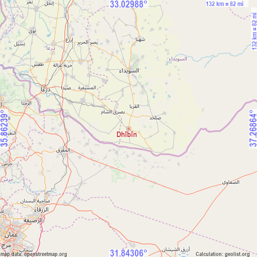
Dhībīn GPS coordinates[2]
32° 26' 18.312" North, 36° 33' 55.836" East
| Map corner | latitude | longitude |
|---|---|---|
| Upper-left | 33.02988°, | 35.86239° |
| Center: | 32.43842°, | 36.56551° |
| Lower-right: | 31.84306°, | 37.26864° |
| Map W x H: | 132×132 km | = 82×82mi |
| max Lat: | 37.17701° ⇑99.6% North |
| Dhībīn: | 32.43842° |
| min Lat: | ⇓0.4% South 32.39332° |
| min Long | Dhībīn | max Long |
| 35.75572° | 36.56551° | 42.14006° |
| W 48.1%⇐ | ⇒51.9% E |
Elevation
Elevation of Dhībīn is 980 m = 3215 ft, and this is 450.9 m = 1479 ft above average elevation for this country.
| Max E: |
1640 m = 5381 ft | 8.1% |
| Dhībīn | 980 m 3215 ft | |
| Avg. | 529.1 m = 1736 ft | |
Min E: |
4 m = 13 ft | 91.9% |
See also: Syria elevation on elevation.city.
Geographical zone
Dhībīn is located in North temperate zone (between Tropic of Cancer and the Arctic Circle). Distance of this Northern Tropic circle is 1000.9 km =621.9 mi to South.| Distance of | km | miles | from Dhībīn |
|---|---|---|---|
| North Pole | 6400.2 | 3976.9 | to North |
| Arctic Circle | 3794.4 | 2357.7 | to North |
| Tropic Cancer | 1000.9 | 621.9 | to South |
| Equator | 3606.8 | 2241.2 | to South |


Nearby cities:
15 places around Dhībīn: (largest is in red/bold)
• Al Ghāriyah
9.4 km =5.8 mi,  122°
122°
• Al Jīzah
27.6 km =17.1 mi,  301°
301°
• Al Mazra‘ah
39.3 km =24.4 mi,  347°
347°
• Al Musayfirah
30.2 km =18.8 mi,  315°
315°
• Al Mushannaf
38.8 km =24.1 mi,  30°
30°
• Al Qurayyā
12.1 km =7.5 mi,  14°
14°
• Al Ḩarāk
42 km =26.1 mi,  325°
325°
• As-Suwayda
30.1 km =18.7 mi,  0°
0°
• Buşrá ash Shām
12 km =7.5 mi, 319°
• Dar‘ā
47.9 km =29.8 mi,  294°
294°
• Khirbat Ghazālah
47.1 km =29.3 mi,  314°
314°
• Malaḩ
28.4 km =17.6 mi,  74°
74°
• Shahbā
46.7 km =29 mi, 7°
• Şalkhad
14.9 km =9.3 mi, 66°
• Şalākhid
48.3 km =30 mi, 0°
Sources, notices
• [Note1] Compared only with cities in Syria existing in our database
• [Src1] Map data: © OpenStreetMap contributors (CC-BY-SA)
• [Src2] Other city data from geonames.org with taken over terms of usage.
• [Src3] Geographical zone / Annual Mean Temperature by Robert A. Rohde @ Wikipedia
