Malaḩ geodata
Malaḩ (As-Suwayda) is a seat of a third-order administrative division; located in Syria in Asia/Damascus (GMT+3) time zone. In our database, there are 87 cities with bigger population. Compared to other cities in Syria, 98.9% of cities are located further ↑North; 66.8% of cities are located further ←West and 97.2% of cities have lower elevation than Malaḩ. Note1


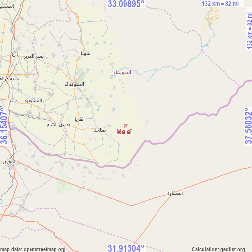
Malaḩ GPS coordinates[2]
32° 30' 28.62" North, 36° 51' 25.884" East
| Map corner | latitude | longitude |
|---|---|---|
| Upper-left | 33.09895°, | 36.15407° |
| Center: | 32.50795°, | 36.85719° |
| Lower-right: | 31.91304°, | 37.56032° |
| Map W x H: | 131.9×131.9 km | = 82×82mi |
| max Lat: | 37.17701° ⇑98.9% North |
| Malaḩ: | 32.50795° |
| min Lat: | ⇓1.1% South 32.39332° |
| min Long | Malaḩ | max Long |
| 35.75572° | 36.85719° | 42.14006° |
| W 66.8%⇐ | ⇒33.2% E |
Elevation
Elevation of Malaḩ is 1361 m = 4465 ft, and this is 831.9 m = 2729 ft above average elevation for this country.
| Max E: |
1640 m = 5381 ft | 2.8% |
| Malaḩ | 1361 m 4465 ft | |
| Avg. | 529.1 m = 1736 ft | |
Min E: |
4 m = 13 ft | 97.2% |
See also: Syria elevation on elevation.city.
Geographical zone
Malaḩ is located in North temperate zone (between Tropic of Cancer and the Arctic Circle). Distance of this Northern Tropic circle is 1008.6 km =626.7 mi to South.| Distance of | km | miles | from Malaḩ |
|---|---|---|---|
| North Pole | 6392.5 | 3972.1 | to North |
| Arctic Circle | 3786.6 | 2352.9 | to North |
| Tropic Cancer | 1008.6 | 626.7 | to South |
| Equator | 3614.5 | 2245.9 | to South |


Nearby cities:
15 places around Malaḩ: (largest is in red/bold)
• Al Ghāriyah
23.2 km =14.4 mi,  236°
236°
• Al Jīzah
51.2 km =31.8 mi,  277°
277°
• Al Mazra‘ah
47 km =29.2 mi,  310°
310°
• Al Musayfirah
50.4 km =31.3 mi,  285°
285°
• Al Mushannaf
26.9 km =16.7 mi,  343°
343°
• Al Qurayyā
24.6 km =15.3 mi, 279°
• Al Ḩarāk
57.8 km =35.9 mi,  297°
297°
• As-Suwayda
35 km =21.7 mi, 309°
• Buşrá ash Shām
35.2 km =21.9 mi,  272°
272°
• Dhībīn
28.4 km =17.6 mi,  254°
254°
• Shahbā
44.1 km =27.4 mi,  331°
331°
• Shaqqā
45.9 km =28.5 mi, 340°
• Şalkhad
13.8 km =8.6 mi,  262°
262°
• Şalākhid
48.5 km =30.1 mi, 326°
• ‘Arīqah
55 km =34.2 mi,  320°
320°
Sources, notices
• [Note1] Compared only with cities in Syria existing in our database
• [Src1] Map data: © OpenStreetMap contributors (CC-BY-SA)
• [Src2] Other city data from geonames.org with taken over terms of usage.
• [Src3] Geographical zone / Annual Mean Temperature by Robert A. Rohde @ Wikipedia
