Abū az̧ Z̧uhūr geodata
Abū az̧ Z̧uhūr (Idlib) is a seat of a third-order administrative division; located in Syria in Asia/Damascus (GMT+3) time zone. In our database, there are 87 cities with bigger population. Compared to other cities in Syria, 68.2% of cities are located further ↓South; 70% of cities are located further ←West and 82.7% of cities have higher elevation than Abū az̧ Z̧uhūr. Note1


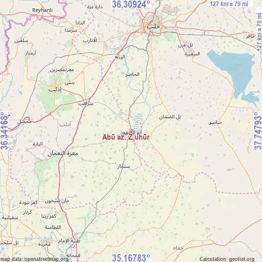
Abū az̧ Z̧uhūr GPS coordinates[2]
35° 44' 26.088" North, 37° 2' 41.28" East
| Map corner | latitude | longitude |
|---|---|---|
| Upper-left | 36.30924°, | 36.34168° |
| Center: | 35.74058°, | 37.0448° |
| Lower-right: | 35.16783°, | 37.74793° |
| Map W x H: | 126.9×126.9 km | = 78.9×78.9mi |
| max Lat: | 37.17701° ⇑31.8% North |
| Abū az̧ Z̧uhūr: | 35.74058° |
| min Lat: | ⇓68.2% South 32.39332° |
| min Long | Abū az̧ Z̧uh | max Long |
| 35.75572° | 37.0448° | 42.14006° |
| W 70%⇐ | ⇒30% E |
Elevation
Elevation of Abū az̧ Z̧uhūr is 259 m = 850 ft, and this is 270.1 m = 886 ft below average elevation for this country.
| Max E: |
1640 m = 5381 ft | 82.7% |
| Avg. | 529.1 m = 1736 ft | |
| Abū az̧ Z̧uhūr | 259 m = 850 ft | |
Min E: |
4 m = 13 ft | 17.3% |
See also: Syria elevation on elevation.city.
Geographical zone
Abū az̧ Z̧uhūr is located in North temperate zone (between Tropic of Cancer and the Arctic Circle). Distance of this Northern Tropic circle is 1368.1 km =850.1 mi to South.| Distance of | km | miles | from Abū az̧ Z̧uhūr |
|---|---|---|---|
| North Pole | 6033.1 | 3748.8 | to North |
| Arctic Circle | 3427.2 | 2129.6 | to North |
| Tropic Cancer | 1368.1 | 850.1 | to South |
| Equator | 3974 | 2469.3 | to South |


Nearby cities:
15 places around Abū az̧ Z̧uhūr: (largest is in red/bold)
• Al Ḩājib
34.6 km =21.5 mi,  66°
66°
• Al Ḩāḑir
27.8 km =17.3 mi,  1°
1°
• Arīḩā
40.1 km =24.9 mi,  281°
281°
• At Tamāni‘ah
41.3 km =25.7 mi,  220°
220°
• Az Zarbah
36.8 km =22.9 mi,  350°
350°
• Banān
34.8 km =21.6 mi,  41°
41°
• Binnish
38.3 km =23.8 mi,  308°
308°
• Khanāşir
41.3 km =25.7 mi,  83°
83°
• Ma‘arrat an Nu‘mān
34.8 km =21.6 mi,  252°
252°
• Sarmīn
34.1 km =21.2 mi,  302°
302°
• Sarāqib
25.6 km =15.9 mi, 302°
• Sinjār
17.1 km =10.6 mi,  192°
192°
• Taftanāz
37 km =23 mi,  320°
320°
• Tall aḑ Ḑamān
20.3 km =12.6 mi, 68°
• Ḩīsh
42.1 km =26.2 mi,  239°
239°
Sources, notices
• [Note1] Compared only with cities in Syria existing in our database
• [Src1] Map data: © OpenStreetMap contributors (CC-BY-SA)
• [Src2] Other city data from geonames.org with taken over terms of usage.
• [Src3] Geographical zone / Annual Mean Temperature by Robert A. Rohde @ Wikipedia
