Banān geodata
Banān (Aleppo) is a seat of a third-order administrative division; located in Syria in Asia/Damascus (GMT+3) time zone. In our database, there are 87 cities with bigger population. Compared to other cities in Syria, 77% of cities are located further ↓South; 76.3% of cities are located further ←West and 54.8% of cities have lower elevation than Banān. Note1


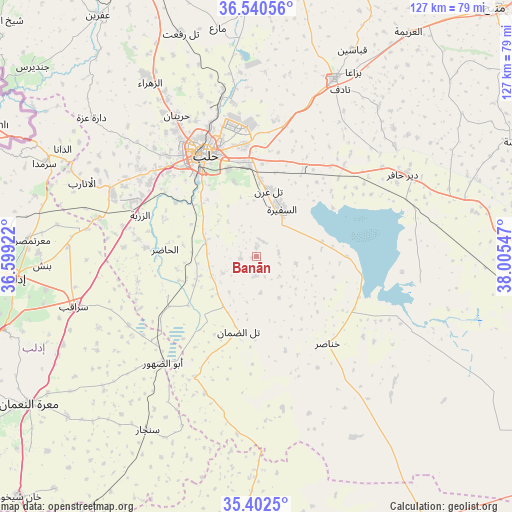
Banān GPS coordinates[2]
35° 58' 24.888" North, 37° 18' 8.424" East
| Map corner | latitude | longitude |
|---|---|---|
| Upper-left | 36.54056°, | 36.59922° |
| Center: | 35.97358°, | 37.30234° |
| Lower-right: | 35.4025°, | 38.00547° |
| Map W x H: | 126.5×126.5 km | = 78.6×78.6mi |
| max Lat: | 37.17701° ⇑23% North |
| Banān: | 35.97358° |
| min Lat: | ⇓77% South 32.39332° |
| min Long | Banān | max Long |
| 35.75572° | 37.30234° | 42.14006° |
| W 76.3%⇐ | ⇒23.7% E |
Elevation
Elevation of Banān is 491 m = 1611 ft, and this is 38.1 m = 125 ft below average elevation for this country.
| Max E: |
1640 m = 5381 ft | 45.2% |
| Avg. | 529.1 m = 1736 ft | |
| Banān | 491 m = 1611 ft | |
Min E: |
4 m = 13 ft | 54.8% |
See also: Syria elevation on elevation.city.
Geographical zone
Banān is located in North temperate zone (between Tropic of Cancer and the Arctic Circle). Distance of this Northern Tropic circle is 1394 km =866.2 mi to South.| Distance of | km | miles | from Banān |
|---|---|---|---|
| North Pole | 6007.2 | 3732.7 | to North |
| Arctic Circle | 3401.3 | 2113.5 | to North |
| Tropic Cancer | 1394 | 866.2 | to South |
| Equator | 3999.9 | 2485.4 | to South |


Nearby cities:
15 places around Banān: (largest is in red/bold)
• Abū az̧ Z̧uhūr
34.8 km =21.6 mi,  221°
221°
• Al Ḩājib
14.9 km =9.3 mi,  145°
145°
• Al Ḩāḑir
22.7 km =14.1 mi,  274°
274°
• Aleppo
28.3 km =17.6 mi,  333°
333°
• As Safīrah
13.1 km =8.1 mi,  28°
28°
• Az Zarbah
30.8 km =19.1 mi,  289°
289°
• Dayr Ḩāfir
41.8 km =26 mi,  60°
60°
• Kafr Şaghīr
35.7 km =22.2 mi,  353°
353°
• Khanāşir
27.8 km =17.3 mi,  140°
140°
• Kuwayris Sharqī
30.2 km =18.8 mi,  44°
44°
• Sarāqib
46.3 km =28.8 mi,  254°
254°
• Taftanāz
46.6 km =29 mi, 273°
• Tall aḑ Ḑamān
18.9 km =11.7 mi,  193°
193°
• Tādif
46.4 km =28.8 mi, 26°
• Ḩuraytān
40.1 km =24.9 mi, 330°
Sources, notices
• [Note1] Compared only with cities in Syria existing in our database
• [Src1] Map data: © OpenStreetMap contributors (CC-BY-SA)
• [Src2] Other city data from geonames.org with taken over terms of usage.
• [Src3] Geographical zone / Annual Mean Temperature by Robert A. Rohde @ Wikipedia
