Az Zarbah geodata
Az Zarbah (Aleppo) is a seat of a third-order administrative division; located in Syria in Asia/Damascus (GMT+3) time zone. In our database, there are 87 cities with bigger population. Compared to other cities in Syria, 79.2% of cities are located further ↓South; 68.9% of cities are located further ←West and 80.2% of cities have higher elevation than Az Zarbah. Note1


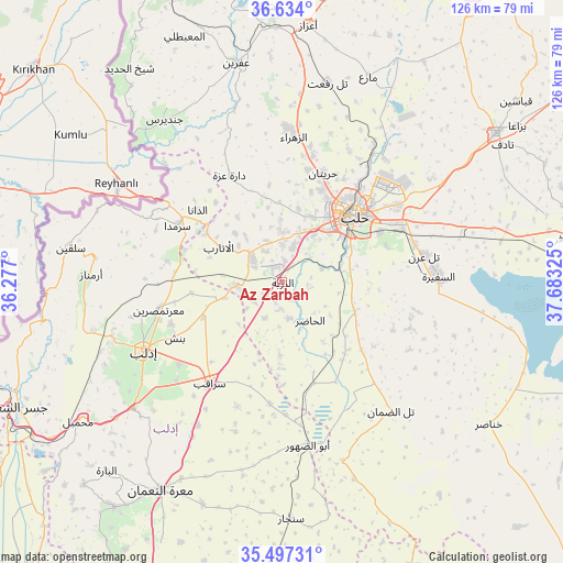
Az Zarbah GPS coordinates[2]
36° 4' 3.756" North, 36° 58' 48.432" East
| Map corner | latitude | longitude |
|---|---|---|
| Upper-left | 36.634°, | 36.277° |
| Center: | 36.06771°, | 36.98012° |
| Lower-right: | 35.49731°, | 37.68325° |
| Map W x H: | 126.4×126.4 km | = 78.5×78.5mi |
| max Lat: | 37.17701° ⇑20.8% North |
| Az Zarbah: | 36.06771° |
| min Lat: | ⇓79.2% South 32.39332° |
| min Long | Az Zarbah | max Long |
| 35.75572° | 36.98012° | 42.14006° |
| W 68.9%⇐ | ⇒31.1% E |
Elevation
Elevation of Az Zarbah is 272 m = 892 ft, and this is 257.1 m = 844 ft below average elevation for this country.
| Max E: |
1640 m = 5381 ft | 80.2% |
| Avg. | 529.1 m = 1736 ft | |
| Az Zarbah | 272 m = 892 ft | |
Min E: |
4 m = 13 ft | 19.8% |
See also: Syria elevation on elevation.city.
Geographical zone
Az Zarbah is located in North temperate zone (between Tropic of Cancer and the Arctic Circle). Distance of this Northern Tropic circle is 1404.4 km =872.7 mi to South.| Distance of | km | miles | from Az Zarbah |
|---|---|---|---|
| North Pole | 5996.7 | 3726.2 | to North |
| Arctic Circle | 3390.8 | 2106.9 | to North |
| Tropic Cancer | 1404.4 | 872.7 | to South |
| Equator | 4010.4 | 2491.9 | to South |


Nearby cities:
15 places around Az Zarbah: (largest is in red/bold)
• Ad Dānā
24.8 km =15.4 mi,  310°
310°
• Al Atārib
16 km =9.9 mi,  299°
299°
• Al Ḩāḑir
10.7 km =6.6 mi,  143°
143°
• Aleppo
22 km =13.7 mi,  47°
47°
• Banān
30.8 km =19.1 mi,  109°
109°
• Binnish
26.9 km =16.7 mi,  242°
242°
• Dārat ‘Izzah
26.5 km =16.5 mi,  334°
334°
• Idlib
34.7 km =21.6 mi, 243°
• Ma‘arratmişrīn
28.4 km =17.6 mi,  257°
257°
• Nubl
34.6 km =21.5 mi,  1°
1°
• Qarqania
34 km =21.1 mi,  283°
283°
• Sarmīn
29.3 km =18.2 mi,  231°
231°
• Sarāqib
27.5 km =17.1 mi,  214°
214°
• Taftanāz
19.1 km =11.9 mi,  246°
246°
• Ḩuraytān
26.3 km =16.3 mi,  21°
21°
Sources, notices
• [Note1] Compared only with cities in Syria existing in our database
• [Src1] Map data: © OpenStreetMap contributors (CC-BY-SA)
• [Src2] Other city data from geonames.org with taken over terms of usage.
• [Src3] Geographical zone / Annual Mean Temperature by Robert A. Rohde @ Wikipedia
