Pa Daet geodata
Pa Daet (Chiang Rai) is a seat of a second-order administrative division; located in Thailand in Asia/Bangkok (GMT+7) time zone. With population of 13,624 people, there are 240 cities with bigger population in this country. Compared to other cities in Thailand, 97.4% of cities are located further ↓South; 72.7% of cities are located further →East and 94.6% of cities have lower elevation than Pa Daet. Note1


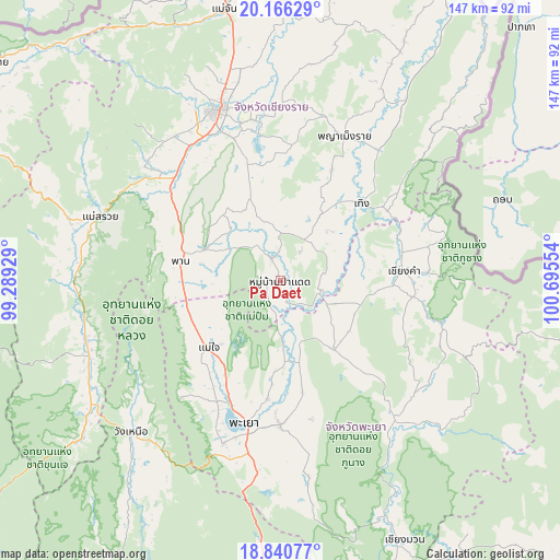
Pa Daet GPS coordinates[2]
19° 30' 17.604" North, 99° 59' 32.676" East
| Map corner | latitude | longitude |
|---|---|---|
| Upper-left | 20.16629°, | 99.28929° |
| Center: | 19.50489°, | 99.99241° |
| Lower-right: | 18.84077°, | 100.69554° |
| Map W x H: | 147.4×147.4 km | = 91.6×91.6mi |
| max Lat: | 20.43353° ⇑2.6% North |
| Pa Daet: | 19.50489° |
| min Lat: | ⇓97.4% South 5.77434° |
| min Long | Pa Daet | max Long |
| 97.93288° | 99.99241° | 105.49506° |
| W 27.3%⇐ | ⇒72.7% E |
Elevation
Elevation of Pa Daet is 384 m = 1260 ft, and this is 258.5 m = 848 ft above average elevation for this country.
| Max E: |
1011 m = 3317 ft | 5.4% |
| Pa Daet | 384 m 1260 ft | |
| Avg. | 125.5 m = 412 ft | |
Min E: |
1 m = 3 ft | 94.6% |
See also: Thailand elevation on elevation.city.
Geographical zone
Pa Daet is located in North Torrid zone (between Equator and Tropic of Cancer). Distance of this Northern Tropic circle is 437.2 km =271.7 mi to North.| Distance of | km | miles | from Pa Daet |
|---|---|---|---|
| North Pole | 7838.3 | 4870.5 | to North |
| Arctic Circle | 5232.4 | 3251.3 | to North |
| Tropic Cancer | 437.2 | 271.7 | to North |
| Equator | 2168.7 | 1347.6 | to South |


Nearby cities:
15 places around Pa Daet: (largest is in red/bold)
• Chiang Kham
32.3 km =20.1 mi,  86°
86°
• Chiang Rai
47.9 km =29.8 mi,  339°
339°
• Chun
23.9 km =14.9 mi,  141°
141°
• Dok Kham Tai
38.1 km =23.7 mi,  179°
179°
• Khun Tan
46 km =28.6 mi,  37°
37°
• Mae Chai
25.7 km =16 mi,  226°
226°
• Mae Lao
44.1 km =27.4 mi,  315°
315°
• Phan
27 km =16.8 mi,  281°
281°
• Phaya Mengrai
41.8 km =26 mi,  23°
23°
• Phayao
36.8 km =22.9 mi,  198°
198°
• Phu Kam Yao
26.2 km =16.3 mi,  185°
185°
• Phu Sang
36.3 km =22.6 mi,  73°
73°
• Pong
49.4 km =30.7 mi, 143°
• Thoeng
29.2 km =18.1 mi,  46°
46°
• Wiang Chai
42.6 km =26.5 mi,  351°
351°
Sources, notices
• [Note1] Compared only with cities in Thailand existing in our database
• [Src1] Map data: © OpenStreetMap contributors (CC-BY-SA)
• [Src2] Other city data from geonames.org with taken over terms of usage.
• [Src3] Geographical zone / Annual Mean Temperature by Robert A. Rohde @ Wikipedia
