Don Chan geodata
Don Chan (Kalasin) is a seat of a second-order administrative division; located in Thailand in Asia/Bangkok (GMT+7) time zone. In our database, there are 331 cities with bigger population. Compared to other cities in Thailand, 71.6% of cities are located further ↓South; 86.7% of cities are located further ←West and 71.9% of cities have lower elevation than Don Chan. Note1


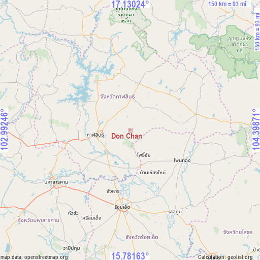
Don Chan GPS coordinates[2]
16° 27' 25.596" North, 103° 41' 44.088" East
| Map corner | latitude | longitude |
|---|---|---|
| Upper-left | 17.13024°, | 102.99246° |
| Center: | 16.45711°, | 103.69558° |
| Lower-right: | 15.78163°, | 104.39871° |
| Map W x H: | 150×150 km | = 93.2×93.2mi |
| max Lat: | 20.43353° ⇑28.4% North |
| Don Chan: | 16.45711° |
| min Lat: | ⇓71.6% South 5.77434° |
| min Long | Don Chan | max Long |
| 97.93288° | 103.69558° | 105.49506° |
| W 86.7%⇐ | ⇒13.3% E |
Elevation
Elevation of Don Chan is 174 m = 571 ft, and this is 48.5 m = 159 ft above average elevation for this country.
| Max E: |
1011 m = 3317 ft | 28.1% |
| Don Chan | 174 m 571 ft | |
| Avg. | 125.5 m = 412 ft | |
Min E: |
1 m = 3 ft | 71.9% |
See also: Thailand elevation on elevation.city.
Geographical zone
Don Chan is located in North Torrid zone (between Equator and Tropic of Cancer). Distance of this Northern Tropic circle is 776.1 km =482.2 mi to North.| Distance of | km | miles | from Don Chan |
|---|---|---|---|
| North Pole | 8177.2 | 5081.1 | to North |
| Arctic Circle | 5571.3 | 3461.8 | to North |
| Tropic Cancer | 776.1 | 482.2 | to North |
| Equator | 1829.9 | 1137 | to South |


Nearby cities:
15 places around Don Chan: (largest is in red/bold)
• Changhan
36.7 km =22.8 mi,  195°
195°
• Chiang Khwan
33.3 km =20.7 mi,  169°
169°
• Huai Phueng
31.4 km =19.5 mi,  46°
46°
• Kalasin
20.3 km =12.6 mi,  262°
262°
• Kamalasai
18.4 km =11.4 mi,  224°
224°
• Kantharawichai
44.7 km =27.8 mi,  251°
251°
• Khong Chai
33.5 km =20.8 mi,  229°
229°
• Kuchinarai
38.9 km =24.2 mi,  76°
76°
• Na Mon
16.5 km =10.3 mi,  36°
36°
• Pho Chai
16.4 km =10.2 mi,  150°
150°
• Rong Kham
21.6 km =13.4 mi, 165°
• Sahatsakhan
34 km =21.1 mi,  326°
326°
• Somdet
28.1 km =17.5 mi,  11°
11°
• Waeng
34.8 km =21.6 mi,  120°
120°
• Yang Talat
35.5 km =22.1 mi, 259°
Sources, notices
• [Note1] Compared only with cities in Thailand existing in our database
• [Src1] Map data: © OpenStreetMap contributors (CC-BY-SA)
• [Src2] Other city data from geonames.org with taken over terms of usage.
• [Src3] Geographical zone / Annual Mean Temperature by Robert A. Rohde @ Wikipedia
