Na Mon geodata
Na Mon (Kalasin) is a seat of a second-order administrative division; located in Thailand in Asia/Bangkok (GMT+7) time zone. In our database, there are 331 cities with bigger population. Compared to other cities in Thailand, 73.1% of cities are located further ↓South; 88.1% of cities are located further ←West and 75.9% of cities have lower elevation than Na Mon. Note1


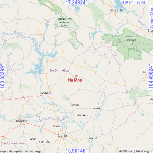
Na Mon GPS coordinates[2]
16° 34' 35.508" North, 103° 47' 13.596" East
| Map corner | latitude | longitude |
|---|---|---|
| Upper-left | 17.24924°, | 103.08399° |
| Center: | 16.57653°, | 103.78711° |
| Lower-right: | 15.90146°, | 104.49024° |
| Map W x H: | 149.9×149.9 km | = 93.1×93.1mi |
| max Lat: | 20.43353° ⇑26.9% North |
| Na Mon: | 16.57653° |
| min Lat: | ⇓73.1% South 5.77434° |
| min Long | Na Mon | max Long |
| 97.93288° | 103.78711° | 105.49506° |
| W 88.1%⇐ | ⇒11.9% E |
Elevation
Elevation of Na Mon is 184 m = 604 ft, and this is 58.5 m = 192 ft above average elevation for this country.
| Max E: |
1011 m = 3317 ft | 24.1% |
| Na Mon | 184 m 604 ft | |
| Avg. | 125.5 m = 412 ft | |
Min E: |
1 m = 3 ft | 75.9% |
See also: Thailand elevation on elevation.city.
Geographical zone
Na Mon is located in North Torrid zone (between Equator and Tropic of Cancer). Distance of this Northern Tropic circle is 762.8 km =474 mi to North.| Distance of | km | miles | from Na Mon |
|---|---|---|---|
| North Pole | 8163.9 | 5072.8 | to North |
| Arctic Circle | 5558 | 3453.6 | to North |
| Tropic Cancer | 762.8 | 474 | to North |
| Equator | 1843.1 | 1145.2 | to South |


Nearby cities:
15 places around Na Mon: (largest is in red/bold)
• Don Chan
16.5 km =10.3 mi,  216°
216°
• Huai Phueng
15.5 km =9.6 mi,  57°
57°
• Kalasin
33.9 km =21.1 mi,  241°
241°
• Kamalasai
34.8 km =21.6 mi, 220°
• Kham Muang
42.4 km =26.3 mi,  337°
337°
• Khao Wong
35.1 km =21.8 mi,  66°
66°
• Kuchinarai
28.3 km =17.6 mi,  98°
98°
• Na Khu
32.9 km =20.4 mi,  50°
50°
• Pho Chai
27.7 km =17.2 mi,  183°
183°
• Rong Kham
34.4 km =21.4 mi,  187°
187°
• Sahatsakhan
32.2 km =20 mi,  297°
297°
• Sam Chai
41.3 km =25.7 mi,  320°
320°
• Samran
41.3 km =25.7 mi, 320°
• Somdet
14.8 km =9.2 mi, 344°
• Waeng
36.9 km =22.9 mi,  146°
146°
Sources, notices
• [Note1] Compared only with cities in Thailand existing in our database
• [Src1] Map data: © OpenStreetMap contributors (CC-BY-SA)
• [Src2] Other city data from geonames.org with taken over terms of usage.
• [Src3] Geographical zone / Annual Mean Temperature by Robert A. Rohde @ Wikipedia
