Kuchinarai geodata
Kuchinarai (Kalasin) is a seat of a second-order administrative division; located in Thailand in Asia/Bangkok (GMT+7) time zone. With population of 20,532 people, there are 152 cities with bigger population in this country. Compared to other cities in Thailand, 72.5% of cities are located further ↓South; 91.1% of cities are located further ←West and 70.1% of cities have lower elevation than Kuchinarai. Note1


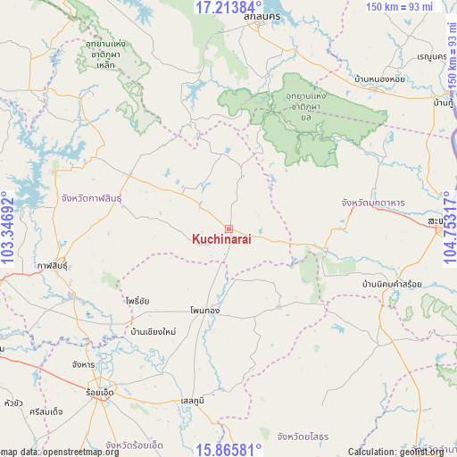
Kuchinarai GPS coordinates[2]
16° 32' 27.6" North, 104° 3' 0.144" East
| Map corner | latitude | longitude |
|---|---|---|
| Upper-left | 17.21384°, | 103.34692° |
| Center: | 16.541°, | 104.05004° |
| Lower-right: | 15.86581°, | 104.75317° |
| Map W x H: | 149.9×149.9 km | = 93.1×93.1mi |
| max Lat: | 20.43353° ⇑27.5% North |
| Kuchinarai: | 16.541° |
| min Lat: | ⇓72.5% South 5.77434° |
| min Long | Kuchinarai | max Long |
| 97.93288° | 104.05004° | 105.49506° |
| W 91.1%⇐ | ⇒8.9% E |
Elevation
Elevation of Kuchinarai is 169 m = 554 ft, and this is 43.5 m = 143 ft above average elevation for this country.
| Max E: |
1011 m = 3317 ft | 29.9% |
| Kuchinarai | 169 m 554 ft | |
| Avg. | 125.5 m = 412 ft | |
Min E: |
1 m = 3 ft | 70.1% |
See also: Thailand elevation on elevation.city.
Geographical zone
Kuchinarai is located in North Torrid zone (between Equator and Tropic of Cancer). Distance of this Northern Tropic circle is 766.7 km =476.4 mi to North.| Distance of | km | miles | from Kuchinarai |
|---|---|---|---|
| North Pole | 8167.9 | 5075.3 | to North |
| Arctic Circle | 5562 | 3456.1 | to North |
| Tropic Cancer | 766.7 | 476.4 | to North |
| Equator | 1839.2 | 1142.8 | to South |


Nearby cities:
15 places around Kuchinarai: (largest is in red/bold)
• Don Chan
38.9 km =24.2 mi,  256°
256°
• Huai Phueng
19.2 km =11.9 mi,  309°
309°
• Khamcha-i
39.6 km =24.6 mi,  84°
84°
• Khao Wong
18.2 km =11.3 mi,  13°
13°
• Moeiwadi
20.4 km =12.7 mi,  145°
145°
• Na Khu
24.9 km =15.5 mi,  354°
354°
• Na Mon
28.3 km =17.6 mi,  278°
278°
• Nong Phok
30.4 km =18.9 mi, 147°
• Nong Sung
32.3 km =20.1 mi,  101°
101°
• Pho Chai
38.1 km =23.7 mi,  231°
231°
• Phu Phan
51.6 km =32.1 mi, 350°
• Rong Kham
44.2 km =27.5 mi, 226°
• Somdet
36.8 km =22.9 mi,  299°
299°
• Tao Ngoi
52.2 km =32.4 mi, 13°
• Waeng
27.9 km =17.3 mi,  196°
196°
Sources, notices
• [Note1] Compared only with cities in Thailand existing in our database
• [Src1] Map data: © OpenStreetMap contributors (CC-BY-SA)
• [Src2] Other city data from geonames.org with taken over terms of usage.
• [Src3] Geographical zone / Annual Mean Temperature by Robert A. Rohde @ Wikipedia
