Suan Phueng geodata
Suan Phueng (Ratchaburi) is a seat of a second-order administrative division; located in Thailand in Asia/Bangkok (GMT+7) time zone. In our database, there are 331 cities with bigger population. Compared to other cities in Thailand, 74.8% of cities are located further ↑North; 87.4% of cities are located further →East and 52.1% of cities have lower elevation than Suan Phueng. Note1


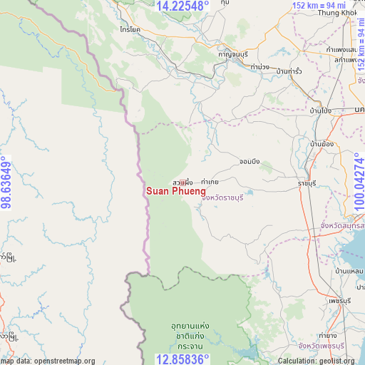
Suan Phueng GPS coordinates[2]
13° 32' 34.44" North, 99° 20' 22.596" East
| Map corner | latitude | longitude |
|---|---|---|
| Upper-left | 14.22548°, | 98.63649° |
| Center: | 13.5429°, | 99.33961° |
| Lower-right: | 12.85836°, | 100.04274° |
| Map W x H: | 152×152 km | = 94.4×94.4mi |
| max Lat: | 20.43353° ⇑74.8% North |
| Suan Phueng: | 13.5429° |
| min Lat: | ⇓25.2% South 5.77434° |
| min Long | Suan Phueng | max Long |
| 97.93288° | 99.33961° | 105.49506° |
| W 12.6%⇐ | ⇒87.4% E |
Elevation
Elevation of Suan Phueng is 124 m = 407 ft, and this is 1.5 m = 5 ft below average elevation for this country.
| Max E: |
1011 m = 3317 ft | 47.9% |
| Avg. | 125.5 m = 412 ft | |
| Suan Phueng | 124 m = 407 ft | |
Min E: |
1 m = 3 ft | 52.1% |
See also: Thailand elevation on elevation.city.
Geographical zone
Suan Phueng is located in North Torrid zone (between Equator and Tropic of Cancer). Distance of this Northern Tropic circle is 1100.1 km =683.6 mi to North.| Distance of | km | miles | from Suan Phueng |
|---|---|---|---|
| North Pole | 8501.2 | 5282.4 | to North |
| Arctic Circle | 5895.3 | 3663.2 | to North |
| Tropic Cancer | 1100.1 | 683.6 | to North |
| Equator | 1505.8 | 935.7 | to South |


Nearby cities:
15 places around Suan Phueng: (largest is in red/bold)
• Ban Kha
14.6 km =9.1 mi,  148°
148°
• Ban Pong
65.6 km =40.8 mi,  62°
62°
• Bang Khon Thi
65.5 km =40.7 mi,  97°
97°
• Chom Bueng
28.6 km =17.8 mi,  72°
72°
• Dan Makham Tia
35.4 km =22 mi,  12°
12°
• Kanchanaburi
56 km =34.8 mi,  23°
23°
• Khao Yoi
62.3 km =38.7 mi,  122°
122°
• Nong Ya Plong
57.3 km =35.6 mi,  137°
137°
• Pak Tho
57.3 km =35.6 mi,  109°
109°
• Photharam
57.6 km =35.8 mi, 73°
• Ratchaburi
51.6 km =32.1 mi,  90°
90°
• Tha Maka
60.9 km =37.8 mi,  49°
49°
• Tha Maka
62.3 km =38.7 mi, 47°
• Tha Muang
56.8 km =35.3 mi,  35°
35°
• Wat Phleng
59.9 km =37.2 mi, 99°
Sources, notices
• [Note1] Compared only with cities in Thailand existing in our database
• [Src1] Map data: © OpenStreetMap contributors (CC-BY-SA)
• [Src2] Other city data from geonames.org with taken over terms of usage.
• [Src3] Geographical zone / Annual Mean Temperature by Robert A. Rohde @ Wikipedia
