Kanchanaburi geodata
Kanchanaburi is a seat of a first-order administrative division; located in Thailand in Asia/Bangkok (GMT+7) time zone. With population of 63,699 people, there are 36 cities with bigger population in this country. Compared to other cities in Thailand, 64.5% of cities are located further ↑North; 84.3% of cities are located further →East and 64.5% of cities have higher elevation than Kanchanaburi. Note1


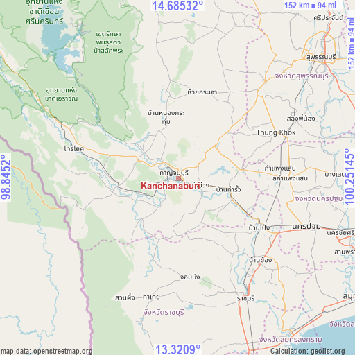
Kanchanaburi GPS coordinates[2]
14° 0' 14.832" North, 99° 32' 53.952" East
| Map corner | latitude | longitude |
|---|---|---|
| Upper-left | 14.68532°, | 98.8452° |
| Center: | 14.00412°, | 99.54832° |
| Lower-right: | 13.3209°, | 100.25145° |
| Map W x H: | 151.7×151.7 km | = 94.3×94.3mi |
| max Lat: | 20.43353° ⇑64.5% North |
| Kanchanaburi: | 14.00412° |
| min Lat: | ⇓35.5% South 5.77434° |
| min Long | Kanchanaburi | max Long |
| 97.93288° | 99.54832° | 105.49506° |
| W 15.7%⇐ | ⇒84.3% E |
Elevation
Elevation of Kanchanaburi is 33 m = 108 ft, and this is 92.5 m = 303 ft below average elevation for this country.
| Max E: |
1011 m = 3317 ft | 64.5% |
| Avg. | 125.5 m = 412 ft | |
| Kanchanaburi | 33 m = 108 ft | |
Min E: |
1 m = 3 ft | 35.5% |
See also: Kanchanaburi elevation on elevation.city.
Geographical zone
Kanchanaburi is located in North Torrid zone (between Equator and Tropic of Cancer). Distance of this Northern Tropic circle is 1048.8 km =651.7 mi to North.| Distance of | km | miles | from Kanchanaburi |
|---|---|---|---|
| North Pole | 8449.9 | 5250.5 | to North |
| Arctic Circle | 5844.1 | 3631.4 | to North |
| Tropic Cancer | 1048.8 | 651.7 | to North |
| Equator | 1557.1 | 967.5 | to South |


Nearby cities:
15 places around Kanchanaburi: (largest is in red/bold)
• Ban Pong
41.2 km =25.6 mi,  120°
120°
• Bang Phae
53.9 km =33.5 mi,  130°
130°
• Bo Phloi
35.9 km =22.3 mi,  354°
354°
• Chom Bueng
43 km =26.7 mi,  173°
173°
• Dan Makham Tia
22.4 km =13.9 mi,  221°
221°
• Huai Krachao
38.2 km =23.7 mi,  19°
19°
• Kamphaeng Saen
47.6 km =29.6 mi,  90°
90°
• Phanom Thuan
21.4 km =13.3 mi,  49°
49°
• Photharam
47.5 km =29.5 mi,  136°
136°
• Sai Yok
45.6 km =28.3 mi,  286°
286°
• Suan Phueng
56 km =34.8 mi,  203°
203°
• Tha Maka
25.2 km =15.7 mi,  111°
111°
• Tha Maka
26.3 km =16.3 mi, 116°
• Tha Muang
11.1 km =6.9 mi, 115°
• U Thong
55.5 km =34.5 mi,  41°
41°
Sources, notices
• [Note1] Compared only with cities in Thailand existing in our database
• [Src1] Map data: © OpenStreetMap contributors (CC-BY-SA)
• [Src2] Other city data from geonames.org with taken over terms of usage.
• [Src3] Geographical zone / Annual Mean Temperature by Robert A. Rohde @ Wikipedia
