Chom Bueng geodata
Chom Bueng (Ratchaburi) is a seat of a second-order administrative division; located in Thailand in Asia/Bangkok (GMT+7) time zone. With population of 15,143 people, there are 217 cities with bigger population in this country. Compared to other cities in Thailand, 73.7% of cities are located further ↑North; 83.4% of cities are located further →East and 50.4% of cities have higher elevation than Chom Bueng. Note1


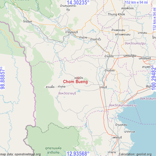
Chom Bueng GPS coordinates[2]
13° 37' 12" North, 99° 35' 30.084" East
| Map corner | latitude | longitude |
|---|---|---|
| Upper-left | 14.30235°, | 98.88857° |
| Center: | 13.62°, | 99.59169° |
| Lower-right: | 12.93568°, | 100.29482° |
| Map W x H: | 152×152 km | = 94.4×94.4mi |
| max Lat: | 20.43353° ⇑73.7% North |
| Chom Bueng: | 13.62° |
| min Lat: | ⇓26.3% South 5.77434° |
| min Long | Chom Bueng | max Long |
| 97.93288° | 99.59169° | 105.49506° |
| W 16.6%⇐ | ⇒83.4% E |
Elevation
Elevation of Chom Bueng is 89 m = 292 ft, and this is 36.5 m = 120 ft below average elevation for this country.
| Max E: |
1011 m = 3317 ft | 50.4% |
| Avg. | 125.5 m = 412 ft | |
| Chom Bueng | 89 m = 292 ft | |
Min E: |
1 m = 3 ft | 49.6% |
See also: Thailand elevation on elevation.city.
Geographical zone
Chom Bueng is located in North Torrid zone (between Equator and Tropic of Cancer). Distance of this Northern Tropic circle is 1091.5 km =678.2 mi to North.| Distance of | km | miles | from Chom Bueng |
|---|---|---|---|
| North Pole | 8492.7 | 5277.1 | to North |
| Arctic Circle | 5886.8 | 3657.9 | to North |
| Tropic Cancer | 1091.5 | 678.2 | to North |
| Equator | 1514.4 | 941 | to South |


Nearby cities:
15 places around Chom Bueng: (largest is in red/bold)
• Ban Kha
28.8 km =17.9 mi,  223°
223°
• Ban Pong
37.8 km =23.5 mi,  54°
54°
• Bang Khon Thi
41.2 km =25.6 mi,  114°
114°
• Bang Phae
37.4 km =23.2 mi,  77°
77°
• Damnoen Saduak
40.8 km =25.4 mi, 106°
• Dan Makham Tia
32.5 km =20.2 mi,  322°
322°
• Kanchanaburi
43 km =26.7 mi,  353°
353°
• Pak Tho
38.4 km =23.9 mi,  135°
135°
• Photharam
29 km =18 mi,  73°
73°
• Ratchaburi
26.1 km =16.2 mi, 110°
• Suan Phueng
28.6 km =17.8 mi,  252°
252°
• Tha Maka
36.4 km =22.6 mi,  31°
31°
• Tha Maka
38.4 km =23.9 mi, 29°
• Tha Muang
38.3 km =23.8 mi,  8°
8°
• Wat Phleng
36.8 km =22.9 mi,  120°
120°
Sources, notices
• [Note1] Compared only with cities in Thailand existing in our database
• [Src1] Map data: © OpenStreetMap contributors (CC-BY-SA)
• [Src2] Other city data from geonames.org with taken over terms of usage.
• [Src3] Geographical zone / Annual Mean Temperature by Robert A. Rohde @ Wikipedia
