Li geodata
Li (Lamphun) is a seat of a second-order administrative division; located in Thailand in Asia/Bangkok (GMT+7) time zone. In our database, there are 331 cities with bigger population. Compared to other cities in Thailand, 86.8% of cities are located further ↓South; 92.5% of cities are located further →East and 97.2% of cities have lower elevation than Li. Note1


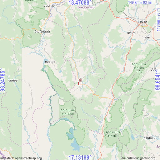
Li GPS coordinates[2]
17° 48' 9.684" North, 98° 57' 3.492" East
| Map corner | latitude | longitude |
|---|---|---|
| Upper-left | 18.47088°, | 98.24785° |
| Center: | 17.80269°, | 98.95097° |
| Lower-right: | 17.13199°, | 99.6541° |
| Map W x H: | 148.9×148.9 km | = 92.5×92.5mi |
| max Lat: | 20.43353° ⇑13.2% North |
| Li: | 17.80269° |
| min Lat: | ⇓86.8% South 5.77434° |
| min Long | Li | max Long |
| 97.93288° | 98.95097° | 105.49506° |
| W 7.5%⇐ | ⇒92.5% E |
Elevation
Elevation of Li is 458 m = 1503 ft, and this is 332.5 m = 1091 ft above average elevation for this country.
| Max E: |
1011 m = 3317 ft | 2.8% |
| Li | 458 m 1503 ft | |
| Avg. | 125.5 m = 412 ft | |
Min E: |
1 m = 3 ft | 97.2% |
See also: Thailand elevation on elevation.city.
Geographical zone
Li is located in North Torrid zone (between Equator and Tropic of Cancer). Distance of this Northern Tropic circle is 626.4 km =389.2 mi to North.| Distance of | km | miles | from Li |
|---|---|---|---|
| North Pole | 8027.6 | 4988.1 | to North |
| Arctic Circle | 5421.7 | 3368.9 | to North |
| Tropic Cancer | 626.4 | 389.2 | to North |
| Equator | 1979.5 | 1230 | to South |


Nearby cities:
15 places around Li: (largest is in red/bold)
• Ban Hong
60.4 km =37.5 mi,  346°
346°
• Doi Tao
32.8 km =20.4 mi,  300°
300°
• Hang Chat
71.9 km =44.7 mi,  35°
35°
• Hot
56.4 km =35 mi,  320°
320°
• Ko Kha
63.8 km =39.6 mi,  47°
47°
• Mae Phrik
43.2 km =26.8 mi,  156°
156°
• Mae Tha
70 km =43.5 mi,  58°
58°
• Om Koi
62.6 km =38.9 mi,  269°
269°
• Sam Ngao
62.7 km =39 mi,  173°
173°
• Soem Ngam
42.7 km =26.5 mi, 46°
• Sop Prap
41.8 km =26 mi,  78°
78°
• Thoen
35.1 km =21.8 mi,  126°
126°
• Thung Hua Chang
23.7 km =14.7 mi,  20°
20°
• Wang Chin
70.3 km =43.7 mi, 82°
• Wiang Nong Long
71.9 km =44.7 mi,  342°
342°
Sources, notices
• [Note1] Compared only with cities in Thailand existing in our database
• [Src1] Map data: © OpenStreetMap contributors (CC-BY-SA)
• [Src2] Other city data from geonames.org with taken over terms of usage.
• [Src3] Geographical zone / Annual Mean Temperature by Robert A. Rohde @ Wikipedia
