Sop Prap geodata
Sop Prap (Lampang) is a seat of a second-order administrative division; located in Thailand in Asia/Bangkok (GMT+7) time zone. In our database, there are 331 cities with bigger population. Compared to other cities in Thailand, 87.6% of cities are located further ↓South; 87.5% of cities are located further →East and 81.1% of cities have lower elevation than Sop Prap. Note1


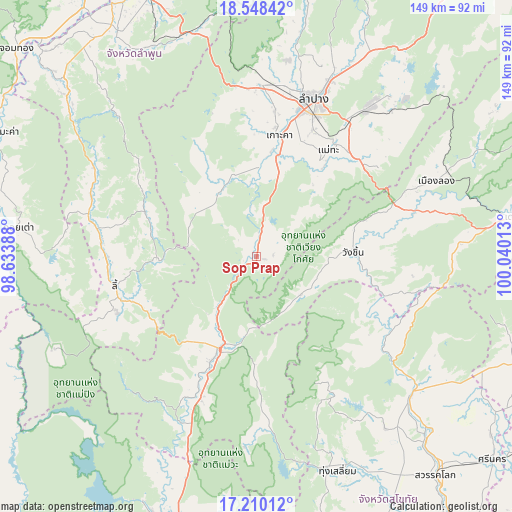
Sop Prap GPS coordinates[2]
17° 52' 49.908" North, 99° 20' 13.2" East
| Map corner | latitude | longitude |
|---|---|---|
| Upper-left | 18.54842°, | 98.63388° |
| Center: | 17.88053°, | 99.337° |
| Lower-right: | 17.21012°, | 100.04013° |
| Map W x H: | 148.8×148.8 km | = 92.5×92.5mi |
| max Lat: | 20.43353° ⇑12.4% North |
| Sop Prap: | 17.88053° |
| min Lat: | ⇓87.6% South 5.77434° |
| min Long | Sop Prap | max Long |
| 97.93288° | 99.337° | 105.49506° |
| W 12.5%⇐ | ⇒87.5% E |
Elevation
Elevation of Sop Prap is 200 m = 656 ft, and this is 74.5 m = 244 ft above average elevation for this country.
| Max E: |
1011 m = 3317 ft | 18.9% |
| Sop Prap | 200 m 656 ft | |
| Avg. | 125.5 m = 412 ft | |
Min E: |
1 m = 3 ft | 81.1% |
See also: Thailand elevation on elevation.city.
Geographical zone
Sop Prap is located in North Torrid zone (between Equator and Tropic of Cancer). Distance of this Northern Tropic circle is 617.8 km =383.9 mi to North.| Distance of | km | miles | from Sop Prap |
|---|---|---|---|
| North Pole | 8018.9 | 4982.7 | to North |
| Arctic Circle | 5413 | 3363.5 | to North |
| Tropic Cancer | 617.8 | 383.9 | to North |
| Equator | 1988.1 | 1235.3 | to South |


Nearby cities:
15 places around Sop Prap: (largest is in red/bold)
• Hang Chat
49.9 km =31 mi,  1°
1°
• Ko Kha
35.2 km =21.9 mi,  9°
9°
• Lampang
48.7 km =30.3 mi,  19°
19°
• Li
41.8 km =26 mi,  258°
258°
• Long
56.5 km =35.1 mi,  67°
67°
• Mae Mo
55 km =34.2 mi,  37°
37°
• Mae Phrik
53.7 km =33.4 mi,  206°
206°
• Mae Tha
33.8 km =21 mi,  33°
33°
• Mae Tha
68.2 km =42.4 mi,  342°
342°
• Si Satchanalai
60.3 km =37.5 mi,  132°
132°
• Soem Ngam
22.7 km =14.1 mi,  334°
334°
• Thoen
32.4 km =20.1 mi,  203°
203°
• Thung Hua Chang
35.4 km =22 mi,  292°
292°
• Thung Saliam
66.6 km =41.4 mi,  159°
159°
• Wang Chin
28.9 km =18 mi,  90°
90°
Sources, notices
• [Note1] Compared only with cities in Thailand existing in our database
• [Src1] Map data: © OpenStreetMap contributors (CC-BY-SA)
• [Src2] Other city data from geonames.org with taken over terms of usage.
• [Src3] Geographical zone / Annual Mean Temperature by Robert A. Rohde @ Wikipedia
