Soem Ngam geodata
Soem Ngam (Lampang) is a seat of a second-order administrative division; located in Thailand in Asia/Bangkok (GMT+7) time zone. In our database, there are 331 cities with bigger population. Compared to other cities in Thailand, 89.8% of cities are located further ↓South; 88.5% of cities are located further →East and 87.9% of cities have lower elevation than Soem Ngam. Note1


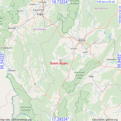
Soem Ngam GPS coordinates[2]
18° 3' 54.216" North, 99° 14' 43.332" East
| Map corner | latitude | longitude |
|---|---|---|
| Upper-left | 18.73224°, | 98.54225° |
| Center: | 18.06506°, | 99.24537° |
| Lower-right: | 17.39534°, | 99.9485° |
| Map W x H: | 148.6×148.7 km | = 92.3×92.4mi |
| max Lat: | 20.43353° ⇑10.2% North |
| Soem Ngam: | 18.06506° |
| min Lat: | ⇓89.8% South 5.77434° |
| min Long | Soem Ngam | max Long |
| 97.93288° | 99.24537° | 105.49506° |
| W 11.5%⇐ | ⇒88.5% E |
Elevation
Elevation of Soem Ngam is 248 m = 814 ft, and this is 122.5 m = 402 ft above average elevation for this country.
| Max E: |
1011 m = 3317 ft | 12.1% |
| Soem Ngam | 248 m 814 ft | |
| Avg. | 125.5 m = 412 ft | |
Min E: |
1 m = 3 ft | 87.9% |
See also: Thailand elevation on elevation.city.
Geographical zone
Soem Ngam is located in North Torrid zone (between Equator and Tropic of Cancer). Distance of this Northern Tropic circle is 597.3 km =371.1 mi to North.| Distance of | km | miles | from Soem Ngam |
|---|---|---|---|
| North Pole | 7998.4 | 4970 | to North |
| Arctic Circle | 5392.5 | 3350.7 | to North |
| Tropic Cancer | 597.3 | 371.1 | to North |
| Equator | 2008.6 | 1248.1 | to South |


Nearby cities:
15 places around Soem Ngam: (largest is in red/bold)
• Ban Hong
53.8 km =33.4 mi,  303°
303°
• Doi Tao
60.6 km =37.7 mi,  258°
258°
• Hang Chat
31.2 km =19.4 mi,  19°
19°
• Ko Kha
21.2 km =13.2 mi,  48°
48°
• Lampang
36.4 km =22.6 mi, 45°
• Li
42.7 km =26.5 mi,  226°
226°
• Long
61.9 km =38.5 mi,  89°
89°
• Mae Mo
48.8 km =30.3 mi,  61°
61°
• Mae Tha
29.4 km =18.3 mi,  74°
74°
• Mae Tha
45.8 km =28.5 mi,  345°
345°
• Pa Sang
60.6 km =37.7 mi,  327°
327°
• Sop Prap
22.7 km =14.1 mi,  154°
154°
• Thoen
50.4 km =31.3 mi,  183°
183°
• Thung Hua Chang
24 km =14.9 mi,  253°
253°
• Wang Chin
43.7 km =27.2 mi,  118°
118°
Sources, notices
• [Note1] Compared only with cities in Thailand existing in our database
• [Src1] Map data: © OpenStreetMap contributors (CC-BY-SA)
• [Src2] Other city data from geonames.org with taken over terms of usage.
• [Src3] Geographical zone / Annual Mean Temperature by Robert A. Rohde @ Wikipedia
