Lan Saka geodata
Lan Saka (Nakhon Si Thammarat) is a seat of a second-order administrative division; located in Thailand in Asia/Bangkok (GMT+7) time zone. In our database, there are 331 cities with bigger population. Compared to other cities in Thailand, 87.4% of cities are located further ↑North; 79.1% of cities are located further →East and 61.5% of cities have higher elevation than Lan Saka. Note1


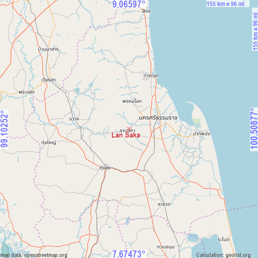
Lan Saka GPS coordinates[2]
8° 22' 15.492" North, 99° 48' 20.304" East
| Map corner | latitude | longitude |
|---|---|---|
| Upper-left | 9.06597°, | 99.10252° |
| Center: | 8.37097°, | 99.80564° |
| Lower-right: | 7.67473°, | 100.50877° |
| Map W x H: | 154.7×154.7 km | = 96.1×96.1mi |
| max Lat: | 20.43353° ⇑87.4% North |
| Lan Saka: | 8.37097° |
| min Lat: | ⇓12.6% South 5.77434° |
| min Long | Lan Saka | max Long |
| 97.93288° | 99.80564° | 105.49506° |
| W 20.9%⇐ | ⇒79.1% E |
Elevation
Elevation of Lan Saka is 41 m = 135 ft, and this is 84.5 m = 277 ft below average elevation for this country.
| Max E: |
1011 m = 3317 ft | 61.5% |
| Avg. | 125.5 m = 412 ft | |
| Lan Saka | 41 m = 135 ft | |
Min E: |
1 m = 3 ft | 38.5% |
See also: Thailand elevation on elevation.city.
Geographical zone
Lan Saka is located in North Torrid zone (between Equator and Tropic of Cancer). Distance of Equator is 930.8 km =578.4 mi to South.| Distance of | km | miles | from Lan Saka |
|---|---|---|---|
| North Pole | 9076.3 | 5639.7 | to North |
| Arctic Circle | 6470.4 | 4020.5 | to North |
| Tropic Cancer | 1675.2 | 1040.9 | to North |
| Equator | 930.8 | 578.4 | to South |


Nearby cities:
15 places around Lan Saka: (largest is in red/bold)
• Chaloem Phra Kiat
33.3 km =20.7 mi,  130°
130°
• Chang Klang
26.7 km =16.6 mi,  269°
269°
• Chawang
33.7 km =20.9 mi,  280°
280°
• Chian Yai
43.5 km =27 mi,  121°
121°
• Chulabhorn
33.5 km =20.8 mi,  167°
167°
• Na Bon
26.2 km =16.3 mi,  242°
242°
• Nakhon Si Thammarat
19 km =11.8 mi,  68°
68°
• Nopphitam
39.5 km =24.5 mi,  350°
350°
• Pak Phanang
43.7 km =27.2 mi,  92°
92°
• Phipun
30.3 km =18.8 mi,  313°
313°
• Phra Phrom
11.1 km =6.9 mi,  108°
108°
• Phrom Khiri
17 km =10.6 mi,  6°
6°
• Ron Phibun
22 km =13.7 mi, 165°
• Tha Sala
35.7 km =22.2 mi,  22°
22°
• Thung Song
26.8 km =16.7 mi,  210°
210°
Sources, notices
• [Note1] Compared only with cities in Thailand existing in our database
• [Src1] Map data: © OpenStreetMap contributors (CC-BY-SA)
• [Src2] Other city data from geonames.org with taken over terms of usage.
• [Src3] Geographical zone / Annual Mean Temperature by Robert A. Rohde @ Wikipedia
