Mae Poen geodata
Mae Poen (Nakhon Sawan) is a seat of a second-order administrative division; located in Thailand in Asia/Bangkok (GMT+7) time zone. In our database, there are 331 cities with bigger population. Compared to other cities in Thailand, 60.9% of cities are located further ↓South; 86% of cities are located further →East and 53.9% of cities have lower elevation than Mae Poen. Note1


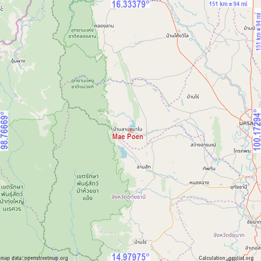
Mae Poen GPS coordinates[2]
15° 39' 28.404" North, 99° 28' 11.316" East
| Map corner | latitude | longitude |
|---|---|---|
| Upper-left | 16.33379°, | 98.76669° |
| Center: | 15.65789°, | 99.46981° |
| Lower-right: | 14.97975°, | 100.17294° |
| Map W x H: | 150.6×150.6 km | = 93.6×93.6mi |
| max Lat: | 20.43353° ⇑39.1% North |
| Mae Poen: | 15.65789° |
| min Lat: | ⇓60.9% South 5.77434° |
| min Long | Mae Poen | max Long |
| 97.93288° | 99.46981° | 105.49506° |
| W 14%⇐ | ⇒86% E |
Elevation
Elevation of Mae Poen is 133 m = 436 ft, and this is 7.5 m = 25 ft above average elevation for this country.
| Max E: |
1011 m = 3317 ft | 46.1% |
| Mae Poen | 133 m 436 ft | |
| Avg. | 125.5 m = 412 ft | |
Min E: |
1 m = 3 ft | 53.9% |
See also: Thailand elevation on elevation.city.
Geographical zone
Mae Poen is located in North Torrid zone (between Equator and Tropic of Cancer). Distance of this Northern Tropic circle is 864.9 km =537.4 mi to North.| Distance of | km | miles | from Mae Poen |
|---|---|---|---|
| North Pole | 8266.1 | 5136.3 | to North |
| Arctic Circle | 5660.2 | 3517.1 | to North |
| Tropic Cancer | 864.9 | 537.4 | to North |
| Equator | 1741 | 1081.8 | to South |


Nearby cities:
15 places around Mae Poen: (largest is in red/bold)
• Ban Rai
64 km =39.8 mi,  175°
175°
• Banphot Phisai
62.8 km =39 mi,  60°
60°
• Chum Ta Bong
9.3 km =5.8 mi,  108°
108°
• Huai Khot
43.7 km =27.2 mi,  158°
158°
• Khanu Woralaksaburi
61.3 km =38.1 mi,  42°
42°
• Khlong Lan
62.7 km =39 mi,  345°
345°
• Lan Sak
25.5 km =15.8 mi,  153°
153°
• Lat Yao
35.7 km =22.2 mi,  73°
73°
• Mae Wong
14.7 km =9.1 mi,  20°
20°
• Nong Chang
49.6 km =30.8 mi,  126°
126°
• Nong Kha Yang
59.1 km =36.7 mi,  123°
123°
• Nong Mamong
60.1 km =37.3 mi, 134°
• Pang Sila Thong
48.8 km =30.3 mi,  2°
2°
• Sawang Arom
42.7 km =26.5 mi,  101°
101°
• Thap Than
50.2 km =31.2 mi, 115°
Sources, notices
• [Note1] Compared only with cities in Thailand existing in our database
• [Src1] Map data: © OpenStreetMap contributors (CC-BY-SA)
• [Src2] Other city data from geonames.org with taken over terms of usage.
• [Src3] Geographical zone / Annual Mean Temperature by Robert A. Rohde @ Wikipedia
