Na Tan geodata
Na Tan (Changwat Ubon Ratchathani) is a seat of a second-order administrative division; located in Thailand in Asia/Bangkok (GMT+7) time zone. In our database, there are 331 cities with bigger population. Compared to other cities in Thailand, 64.3% of cities are located further ↓South; 99.7% of cities are located further ←West and 59.5% of cities have lower elevation than Na Tan. Note1


Na Tan GPS coordinates[2]
15° 53' 50.964" North, 105° 17' 35.448" East
| Map corner | latitude | longitude |
|---|---|---|
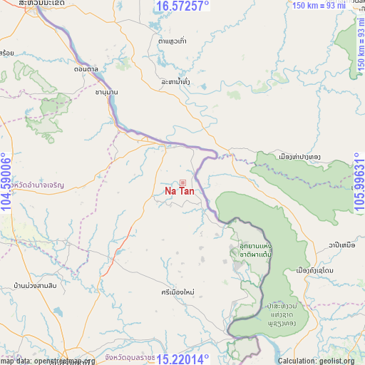
| Upper-left | 16.57257°, | 104.59006° |
| Center: | 15.89749°, | 105.29318° |
| Lower-right: | 15.22014°, | 105.99631° |
| Map W x H: | 150.4×150.4 km | = 93.5×93.5mi |
| max Lat: | 20.43353° ⇑35.7% North |
| Na Tan: | 15.89749° |
| min Lat: | ⇓64.3% South 5.77434° |
| min Long | Na Tan | max Long |
| 97.93288° | 105.29318° | 105.49506° |
| W 99.7%⇐ | ⇒0.3% E |
Elevation
Elevation of Na Tan is 147 m = 482 ft, and this is 21.5 m = 71 ft above average elevation for this country.
| Max E: |
1011 m = 3317 ft | 40.5% |
| Na Tan | 147 m 482 ft | |
| Avg. | 125.5 m = 412 ft | |
Min E: |
1 m = 3 ft | 59.5% |
See also: Thailand elevation on elevation.city.
Geographical zone
Na Tan is located in North Torrid zone (between Equator and Tropic of Cancer). Distance of this Northern Tropic circle is 838.3 km =520.9 mi to North.| Distance of | km | miles | from Na Tan |
|---|---|---|---|
| North Pole | 8239.4 | 5119.7 | to North |
| Arctic Circle | 5633.5 | 3500.5 | to North |
| Tropic Cancer | 838.3 | 520.9 | to North |
| Equator | 1767.6 | 1098.3 | to South |


Nearby cities:
15 places around Na Tan: (largest is in red/bold)
• Amnat Charoen
71.2 km =44.2 mi,  266°
266°
• Chanuman
48.7 km =30.3 mi,  320°
320°
• Don Mot Daeng
64.3 km =40 mi,  206°
206°
• Don Tan
61.4 km =38.2 mi, 319°
• Khemarat
18 km =11.2 mi,  333°
333°
• Khong Chiam
67.9 km =42.2 mi,  161°
161°
• Kut Khaopun
33.6 km =20.9 mi,  249°
249°
• Lao Suea Kok
66.4 km =41.3 mi,  216°
216°
• Pathum Ratchawongsa
41.4 km =25.7 mi, 269°
• Phana
53.5 km =33.2 mi,  243°
243°
• Pho Sai
8.7 km =5.4 mi,  203°
203°
• Senangkhanikhom
68.5 km =42.6 mi,  283°
283°
• Si Mueang Mai
45 km =28 mi,  182°
182°
• Tan Sum
66.4 km =41.3 mi,  192°
192°
• Trakan Phut Phon
43.1 km =26.8 mi, 222°
Sources, notices
• [Note1] Compared only with cities in Thailand existing in our database
• [Src1] Map data: © OpenStreetMap contributors (CC-BY-SA)
• [Src2] Other city data from geonames.org with taken over terms of usage.
• [Src3] Geographical zone / Annual Mean Temperature by Robert A. Rohde @ Wikipedia
