Don Tan geodata
Don Tan (Mukdahan) is a seat of a second-order administrative division; located in Thailand in Asia/Bangkok (GMT+7) time zone. In our database, there are 331 cities with bigger population. Compared to other cities in Thailand, 69.7% of cities are located further ↓South; 98.1% of cities are located further ←West and 64.7% of cities have lower elevation than Don Tan. Note1


Don Tan GPS coordinates[2]
16° 19' 1.092" North, 104° 55' 12" East
| Map corner | latitude | longitude |
|---|---|---|
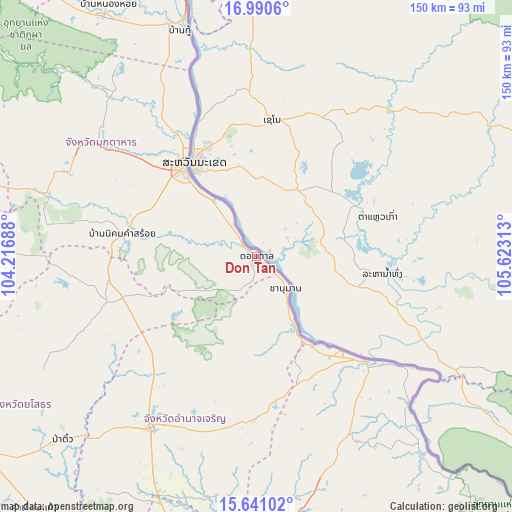
| Upper-left | 16.9906°, | 104.21688° |
| Center: | 16.31697°, | 104.92° |
| Lower-right: | 15.64102°, | 105.62313° |
| Map W x H: | 150.1×150.1 km | = 93.3×93.3mi |
| max Lat: | 20.43353° ⇑30.3% North |
| Don Tan: | 16.31697° |
| min Lat: | ⇓69.7% South 5.77434° |
| min Long | Don Tan | max Long |
| 97.93288° | 104.92° | 105.49506° |
| W 98.1%⇐ | ⇒1.9% E |
Elevation
Elevation of Don Tan is 159 m = 522 ft, and this is 33.5 m = 110 ft above average elevation for this country.
| Max E: |
1011 m = 3317 ft | 35.3% |
| Don Tan | 159 m 522 ft | |
| Avg. | 125.5 m = 412 ft | |
Min E: |
1 m = 3 ft | 64.7% |
See also: Thailand elevation on elevation.city.
Geographical zone
Don Tan is located in North Torrid zone (between Equator and Tropic of Cancer). Distance of this Northern Tropic circle is 791.6 km =491.9 mi to North.| Distance of | km | miles | from Don Tan |
|---|---|---|---|
| North Pole | 8192.8 | 5090.8 | to North |
| Arctic Circle | 5586.9 | 3471.5 | to North |
| Tropic Cancer | 791.6 | 491.9 | to North |
| Equator | 1814.3 | 1127.4 | to South |


Nearby cities:
15 places around Don Tan: (largest is in red/bold)
• Amnat Charoen
59.7 km =37.1 mi,  211°
211°
• Chanuman
12.6 km =7.8 mi,  137°
137°
• Khamcha-i
60.7 km =37.7 mi,  298°
298°
• Khemarat
44.1 km =27.4 mi,  133°
133°
• Kut Khaopun
58.9 km =36.6 mi,  171°
171°
• Loeng Nok Tha
40.8 km =25.4 mi,  252°
252°
• Mukdahan
32.9 km =20.4 mi,  320°
320°
• Na Tan
61.4 km =38.2 mi, 139°
• Nikhom Kham Soi
39.8 km =24.7 mi,  278°
278°
• Nong Sung
63.8 km =39.6 mi,  286°
286°
• Pathum Ratchawongsa
47.3 km =29.4 mi,  181°
181°
• Pho Sai
65.6 km =40.8 mi,  146°
146°
• Senangkhanikhom
40.8 km =25.4 mi,  220°
220°
• Thai Charoen
58.3 km =36.2 mi,  241°
241°
• Wan Yai
48.9 km =30.4 mi,  337°
337°
Sources, notices
• [Note1] Compared only with cities in Thailand existing in our database
• [Src1] Map data: © OpenStreetMap contributors (CC-BY-SA)
• [Src2] Other city data from geonames.org with taken over terms of usage.
• [Src3] Geographical zone / Annual Mean Temperature by Robert A. Rohde @ Wikipedia
