Amnat Charoen geodata
Amnat Charoen is a seat of a first-order administrative division; located in Thailand in Asia/Bangkok (GMT+7) time zone. With population of 34,769 people, there are 95 cities with bigger population in this country. Compared to other cities in Thailand, 63.8% of cities are located further ↓South; 96.1% of cities are located further ←West and 65.9% of cities have lower elevation than Amnat Charoen. Note1


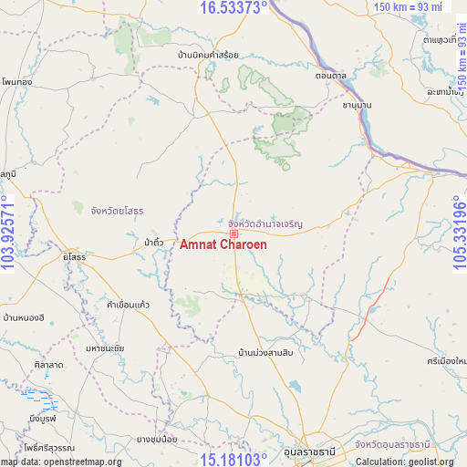
Amnat Charoen GPS coordinates[2]
15° 51' 30.636" North, 104° 37' 43.788" East
| Map corner | latitude | longitude |
|---|---|---|
| Upper-left | 16.53373°, | 103.92571° |
| Center: | 15.85851°, | 104.62883° |
| Lower-right: | 15.18103°, | 105.33196° |
| Map W x H: | 150.4×150.4 km | = 93.5×93.5mi |
| max Lat: | 20.43353° ⇑36.2% North |
| Amnat Charoen: | 15.85851° |
| min Lat: | ⇓63.8% South 5.77434° |
| min Long | Amnat Charoen | max Long |
| 97.93288° | 104.62883° | 105.49506° |
| W 96.1%⇐ | ⇒3.9% E |
Elevation
Elevation of Amnat Charoen is 161 m = 528 ft, and this is 35.5 m = 116 ft above average elevation for this country.
| Max E: |
1011 m = 3317 ft | 34.1% |
| Amnat Charoen | 161 m 528 ft | |
| Avg. | 125.5 m = 412 ft | |
Min E: |
1 m = 3 ft | 65.9% |
See also: Thailand elevation on elevation.city.
Geographical zone
Amnat Charoen is located in North Torrid zone (between Equator and Tropic of Cancer). Distance of this Northern Tropic circle is 842.6 km =523.6 mi to North.| Distance of | km | miles | from Amnat Charoen |
|---|---|---|---|
| North Pole | 8243.8 | 5122.5 | to North |
| Arctic Circle | 5637.9 | 3503.2 | to North |
| Tropic Cancer | 842.6 | 523.6 | to North |
| Equator | 1763.3 | 1095.7 | to South |


Nearby cities:
15 places around Amnat Charoen: (largest is in red/bold)
• Hua Taphan
23.2 km =14.4 mi,  219°
219°
• Kham Khuean Kaeo
41.2 km =25.6 mi,  236°
236°
• Kut Chum
36.5 km =22.7 mi,  302°
302°
• Kut Khaopun
40.2 km =25 mi,  100°
100°
• Loeng Nok Tha
39.6 km =24.6 mi,  348°
348°
• Lue Amnat
18.3 km =11.4 mi,  173°
173°
• Muang Sam Sip
39.8 km =24.7 mi,  164°
164°
• Pa Tio
26.1 km =16.2 mi,  263°
263°
• Pathum Ratchawongsa
29.8 km =18.5 mi,  82°
82°
• Phana
30.4 km =18.9 mi,  130°
130°
• Sai Mun
46 km =28.6 mi,  282°
282°
• Senangkhanikhom
20.6 km =12.8 mi,  12°
12°
• Thai Charoen
30.7 km =19.1 mi,  318°
318°
• Trakan Phut Phon
50.2 km =31.2 mi,  123°
123°
• Yasothon
52.2 km =32.4 mi, 262°
Sources, notices
• [Note1] Compared only with cities in Thailand existing in our database
• [Src1] Map data: © OpenStreetMap contributors (CC-BY-SA)
• [Src2] Other city data from geonames.org with taken over terms of usage.
• [Src3] Geographical zone / Annual Mean Temperature by Robert A. Rohde @ Wikipedia
