Loei geodata
Loei is a seat of a first-order administrative division; located in Thailand in Asia/Bangkok (GMT+7) time zone. With population of 35,273 people, there are 92 cities with bigger population in this country. Compared to other cities in Thailand, 84.2% of cities are located further ↓South; 63.8% of cities are located further ←West and 87.7% of cities have lower elevation than Loei. Note1


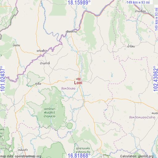
Loei GPS coordinates[2]
17° 29' 25.872" North, 101° 43' 38.964" East
| Map corner | latitude | longitude |
|---|---|---|
| Upper-left | 18.15989°, | 101.02437° |
| Center: | 17.49052°, | 101.72749° |
| Lower-right: | 16.81868°, | 102.43062° |
| Map W x H: | 149.1×149.1 km | = 92.6×92.6mi |
| max Lat: | 20.43353° ⇑15.8% North |
| Loei: | 17.49052° |
| min Lat: | ⇓84.2% South 5.77434° |
| min Long | Loei | max Long |
| 97.93288° | 101.72749° | 105.49506° |
| W 63.8%⇐ | ⇒36.2% E |
Elevation
Elevation of Loei is 244 m = 801 ft, and this is 118.5 m = 389 ft above average elevation for this country.
| Max E: |
1011 m = 3317 ft | 12.3% |
| Loei | 244 m 801 ft | |
| Avg. | 125.5 m = 412 ft | |
Min E: |
1 m = 3 ft | 87.7% |
See also: Thailand elevation on elevation.city.
Geographical zone
Loei is located in North Torrid zone (between Equator and Tropic of Cancer). Distance of this Northern Tropic circle is 661.2 km =410.9 mi to North.| Distance of | km | miles | from Loei |
|---|---|---|---|
| North Pole | 8062.3 | 5009.7 | to North |
| Arctic Circle | 5456.4 | 3390.4 | to North |
| Tropic Cancer | 661.2 | 410.9 | to North |
| Equator | 1944.8 | 1208.4 | to South |


Nearby cities:
15 places around Loei: (largest is in red/bold)
• Chiang Khan
45.4 km =28.2 mi,  350°
350°
• Erawan
31.9 km =19.8 mi,  131°
131°
• Na Klang
53 km =32.9 mi,  112°
112°
• Na Wang
41.5 km =25.8 mi,  116°
116°
• Na Yung
63.6 km =39.5 mi,  44°
44°
• Nam Som
58 km =36 mi,  57°
57°
• Nong Hin
43.1 km =26.8 mi,  161°
161°
• Pak Chom
61.7 km =38.3 mi,  17°
17°
• Pha Khao
57.2 km =35.5 mi,  145°
145°
• Phu Luang
39.6 km =24.6 mi,  189°
189°
• Phu Ruea
38.9 km =24.2 mi,  263°
263°
• Suwanna Khuha
59.1 km =36.7 mi,  82°
82°
• Suwannakhuha
59.1 km =36.7 mi, 82°
• Tha Li
35.7 km =22.2 mi,  294°
294°
• Wang Saphung
21.5 km =13.4 mi,  168°
168°
Sources, notices
• [Note1] Compared only with cities in Thailand existing in our database
• [Src1] Map data: © OpenStreetMap contributors (CC-BY-SA)
• [Src2] Other city data from geonames.org with taken over terms of usage.
• [Src3] Geographical zone / Annual Mean Temperature by Robert A. Rohde @ Wikipedia
