Nam Som geodata
Nam Som (Changwat Udon Thani) is a seat of a second-order administrative division; located in Thailand in Asia/Bangkok (GMT+7) time zone. With population of 19,324 people, there are 163 cities with bigger population in this country. Compared to other cities in Thailand, 86.3% of cities are located further ↓South; 69.1% of cities are located further ←West and 86.8% of cities have lower elevation than Nam Som. Note1


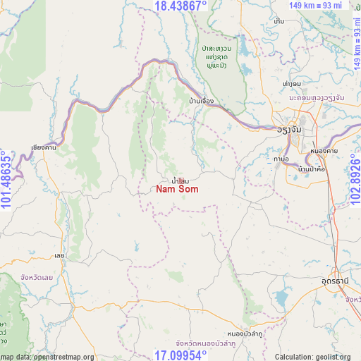
Nam Som GPS coordinates[2]
17° 46' 13.296" North, 102° 11' 22.092" East
| Map corner | latitude | longitude |
|---|---|---|
| Upper-left | 18.43867°, | 101.48635° |
| Center: | 17.77036°, | 102.18947° |
| Lower-right: | 17.09954°, | 102.8926° |
| Map W x H: | 148.9×148.9 km | = 92.5×92.5mi |
| max Lat: | 20.43353° ⇑13.7% North |
| Nam Som: | 17.77036° |
| min Lat: | ⇓86.3% South 5.77434° |
| min Long | Nam Som | max Long |
| 97.93288° | 102.18947° | 105.49506° |
| W 69.1%⇐ | ⇒30.9% E |
Elevation
Elevation of Nam Som is 231 m = 758 ft, and this is 105.5 m = 346 ft above average elevation for this country.
| Max E: |
1011 m = 3317 ft | 13.2% |
| Nam Som | 231 m 758 ft | |
| Avg. | 125.5 m = 412 ft | |
Min E: |
1 m = 3 ft | 86.8% |
See also: Thailand elevation on elevation.city.
Geographical zone
Nam Som is located in North Torrid zone (between Equator and Tropic of Cancer). Distance of this Northern Tropic circle is 630 km =391.5 mi to North.| Distance of | km | miles | from Nam Som |
|---|---|---|---|
| North Pole | 8031.2 | 4990.4 | to North |
| Arctic Circle | 5425.3 | 3371.1 | to North |
| Tropic Cancer | 630 | 391.5 | to North |
| Equator | 1975.9 | 1227.8 | to South |


Nearby cities:
15 places around Nam Som: (largest is in red/bold)
• Ban Phue
32 km =19.9 mi,  106°
106°
• Chiang Khan
57.7 km =35.9 mi,  283°
283°
• Erawan
57.8 km =35.9 mi,  205°
205°
• Kut Chap
55.4 km =34.4 mi,  133°
133°
• Loei
58 km =36 mi,  237°
237°
• Na Klang
51.5 km =32 mi,  180°
180°
• Na Wang
51 km =31.7 mi,  193°
193°
• Na Yung
14.7 km =9.1 mi,  343°
343°
• Pak Chom
41.5 km =25.8 mi,  312°
312°
• Pho Tak
25.5 km =15.8 mi,  62°
62°
• Sangkhom
33.8 km =21 mi,  15°
15°
• Si Chiang Mai
46.8 km =29.1 mi, 63°
• Suwanna Khuha
25 km =15.5 mi,  157°
157°
• Suwannakhuha
25 km =15.5 mi, 157°
• Tha Bo
42.4 km =26.3 mi,  77°
77°
Sources, notices
• [Note1] Compared only with cities in Thailand existing in our database
• [Src1] Map data: © OpenStreetMap contributors (CC-BY-SA)
• [Src2] Other city data from geonames.org with taken over terms of usage.
• [Src3] Geographical zone / Annual Mean Temperature by Robert A. Rohde @ Wikipedia
