Wang Thong geodata
Wang Thong (Phitsanulok) is a seat of a second-order administrative division; located in Thailand in Asia/Bangkok (GMT+7) time zone. In our database, there are 331 cities with bigger population. Compared to other cities in Thailand, 76.3% of cities are located further ↓South; 60.7% of cities are located further →East and 57.9% of cities have higher elevation than Wang Thong. Note1


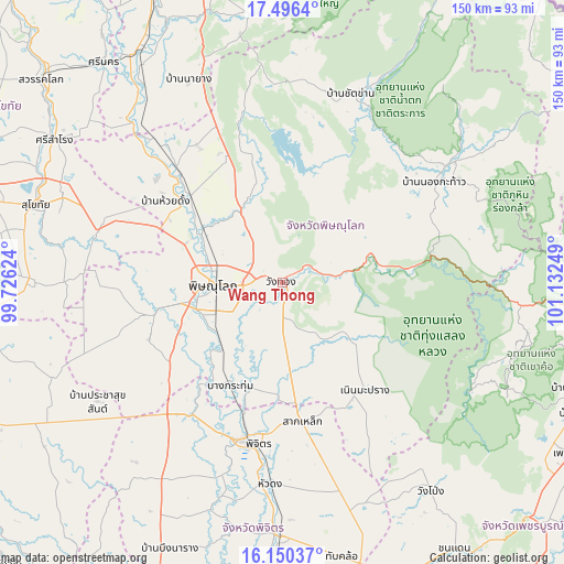
Wang Thong GPS coordinates[2]
16° 49' 28.488" North, 100° 25' 45.696" East
| Map corner | latitude | longitude |
|---|---|---|
| Upper-left | 17.4964°, | 99.72624° |
| Center: | 16.82458°, | 100.42936° |
| Lower-right: | 16.15037°, | 101.13249° |
| Map W x H: | 149.7×149.7 km | = 93×93mi |
| max Lat: | 20.43353° ⇑23.7% North |
| Wang Thong: | 16.82458° |
| min Lat: | ⇓76.3% South 5.77434° |
| min Long | Wang Thong | max Long |
| 97.93288° | 100.42936° | 105.49506° |
| W 39.3%⇐ | ⇒60.7% E |
Elevation
Elevation of Wang Thong is 50 m = 164 ft, and this is 75.5 m = 248 ft below average elevation for this country.
| Max E: |
1011 m = 3317 ft | 57.9% |
| Avg. | 125.5 m = 412 ft | |
| Wang Thong | 50 m = 164 ft | |
Min E: |
1 m = 3 ft | 42.1% |
See also: Thailand elevation on elevation.city.
Geographical zone
Wang Thong is located in North Torrid zone (between Equator and Tropic of Cancer). Distance of this Northern Tropic circle is 735.2 km =456.8 mi to North.| Distance of | km | miles | from Wang Thong |
|---|---|---|---|
| North Pole | 8136.3 | 5055.7 | to North |
| Arctic Circle | 5530.5 | 3436.5 | to North |
| Tropic Cancer | 735.2 | 456.8 | to North |
| Equator | 1870.7 | 1162.4 | to South |


Nearby cities:
15 places around Wang Thong: (largest is in red/bold)
• Bang Krathum
30.6 km =19 mi,  206°
206°
• Bang Rakam
34 km =21.1 mi,  257°
257°
• Chat Trakan
53.4 km =33.2 mi,  19°
19°
• Kong Krailat
50.1 km =31.1 mi,  286°
286°
• Nakhon Thai
53.1 km =33 mi,  54°
54°
• Noen Maprang
36 km =22.4 mi,  142°
142°
• Phichai
63.1 km =39.2 mi,  324°
324°
• Phichit
43.4 km =27 mi,  191°
191°
• Phitsanulok
18.2 km =11.3 mi,  270°
270°
• Phrom Phiram
33.5 km =20.8 mi,  313°
313°
• Sak Lek
35.8 km =22.2 mi,  172°
172°
• Sam Ngam
42.7 km =26.5 mi, 214°
• Wachira Barami
45.2 km =28.1 mi,  222°
222°
• Wang Sai Phun
49.9 km =31 mi, 166°
• Wat Bot
20.3 km =12.6 mi,  329°
329°
Sources, notices
• [Note1] Compared only with cities in Thailand existing in our database
• [Src1] Map data: © OpenStreetMap contributors (CC-BY-SA)
• [Src2] Other city data from geonames.org with taken over terms of usage.
• [Src3] Geographical zone / Annual Mean Temperature by Robert A. Rohde @ Wikipedia
