Phrom Phiram geodata
Phrom Phiram (Phitsanulok) is a seat of a second-order administrative division; located in Thailand in Asia/Bangkok (GMT+7) time zone. In our database, there are 331 cities with bigger population. Compared to other cities in Thailand, 78.8% of cities are located further ↓South; 66.5% of cities are located further →East and 57.3% of cities have higher elevation than Phrom Phiram. Note1


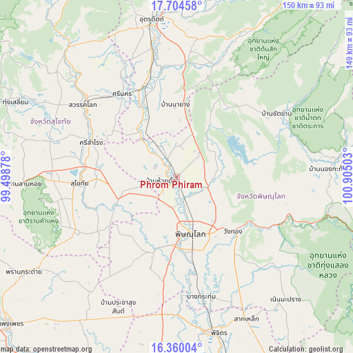
Phrom Phiram GPS coordinates[2]
17° 2' 0.672" North, 100° 12' 6.84" East
| Map corner | latitude | longitude |
|---|---|---|
| Upper-left | 17.70458°, | 99.49878° |
| Center: | 17.03352°, | 100.2019° |
| Lower-right: | 16.36004°, | 100.90503° |
| Map W x H: | 149.5×149.5 km | = 92.9×92.9mi |
| max Lat: | 20.43353° ⇑21.2% North |
| Phrom Phiram: | 17.03352° |
| min Lat: | ⇓78.8% South 5.77434° |
| min Long | Phrom Phiram | max Long |
| 97.93288° | 100.2019° | 105.49506° |
| W 33.5%⇐ | ⇒66.5% E |
Elevation
Elevation of Phrom Phiram is 51 m = 167 ft, and this is 74.5 m = 244 ft below average elevation for this country.
| Max E: |
1011 m = 3317 ft | 57.3% |
| Avg. | 125.5 m = 412 ft | |
| Phrom Phiram | 51 m = 167 ft | |
Min E: |
1 m = 3 ft | 42.7% |
See also: Thailand elevation on elevation.city.
Geographical zone
Phrom Phiram is located in North Torrid zone (between Equator and Tropic of Cancer). Distance of this Northern Tropic circle is 712 km =442.4 mi to North.| Distance of | km | miles | from Phrom Phiram |
|---|---|---|---|
| North Pole | 8113.1 | 5041.2 | to North |
| Arctic Circle | 5507.2 | 3422 | to North |
| Tropic Cancer | 712 | 442.4 | to North |
| Equator | 1893.9 | 1176.8 | to South |


Nearby cities:
15 places around Phrom Phiram: (largest is in red/bold)
• Ban Na
49.9 km =31 mi,  267°
267°
• Bang Rakam
31.9 km =19.8 mi,  196°
196°
• Chat Trakan
50.2 km =31.2 mi,  57°
57°
• Khiri Mat
48.2 km =30 mi,  242°
242°
• Kong Krailat
25.5 km =15.8 mi,  249°
249°
• Phichai
30.8 km =19.1 mi,  336°
336°
• Phitsanulok
24 km =14.9 mi,  165°
165°
• Sawankhalok
50.3 km =31.3 mi,  308°
308°
• Si Nakhon
41.9 km =26 mi,  326°
326°
• Si Samrong
38.9 km =24.2 mi,  291°
291°
• Sukhothai
40.4 km =25.1 mi, 265°
• Thong Saen Khan
50.5 km =31.4 mi,  15°
15°
• Tron
50.7 km =31.5 mi,  349°
349°
• Wang Thong
33.5 km =20.8 mi,  133°
133°
• Wat Bot
15 km =9.3 mi,  112°
112°
Sources, notices
• [Note1] Compared only with cities in Thailand existing in our database
• [Src1] Map data: © OpenStreetMap contributors (CC-BY-SA)
• [Src2] Other city data from geonames.org with taken over terms of usage.
• [Src3] Geographical zone / Annual Mean Temperature by Robert A. Rohde @ Wikipedia
