Chat Trakan geodata
Chat Trakan (Phitsanulok) is a seat of a second-order administrative division; located in Thailand in Asia/Bangkok (GMT+7) time zone. With population of 4,608 people, there are 315 cities with bigger population in this country. Compared to other cities in Thailand, 81.4% of cities are located further ↓South; 53.8% of cities are located further →East and 83.2% of cities have lower elevation than Chat Trakan. Note1


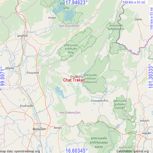
Chat Trakan GPS coordinates[2]
17° 16' 33.816" North, 100° 36' 0.792" East
| Map corner | latitude | longitude |
|---|---|---|
| Upper-left | 17.94623°, | 99.8971° |
| Center: | 17.27606°, | 100.60022° |
| Lower-right: | 16.60345°, | 101.30335° |
| Map W x H: | 149.3×149.3 km | = 92.8×92.8mi |
| max Lat: | 20.43353° ⇑18.6% North |
| Chat Trakan: | 17.27606° |
| min Lat: | ⇓81.4% South 5.77434° |
| min Long | Chat Trakan | max Long |
| 97.93288° | 100.60022° | 105.49506° |
| W 46.2%⇐ | ⇒53.8% E |
Elevation
Elevation of Chat Trakan is 210 m = 689 ft, and this is 84.5 m = 277 ft above average elevation for this country.
| Max E: |
1011 m = 3317 ft | 16.8% |
| Chat Trakan | 210 m 689 ft | |
| Avg. | 125.5 m = 412 ft | |
Min E: |
1 m = 3 ft | 83.2% |
See also: Thailand elevation on elevation.city.
Geographical zone
Chat Trakan is located in North Torrid zone (between Equator and Tropic of Cancer). Distance of this Northern Tropic circle is 685 km =425.6 mi to North.| Distance of | km | miles | from Chat Trakan |
|---|---|---|---|
| North Pole | 8086.1 | 5024.5 | to North |
| Arctic Circle | 5480.3 | 3405.3 | to North |
| Tropic Cancer | 685 | 425.6 | to North |
| Equator | 1920.9 | 1193.6 | to South |


Nearby cities:
15 places around Chat Trakan: (largest is in red/bold)
• Dan Sai
58 km =36 mi,  89°
89°
• Laplae
72.8 km =45.2 mi,  305°
305°
• Na Haeo
54.8 km =34.1 mi,  64°
64°
• Nakhon Thai
31.9 km =19.8 mi,  127°
127°
• Nam Pat
51 km =31.7 mi,  10°
10°
• Phichai
54.5 km =33.9 mi,  271°
271°
• Phitsanulok
61.9 km =38.5 mi,  215°
215°
• Phrom Phiram
50.2 km =31.2 mi,  237°
237°
• Si Nakhon
65.7 km =40.8 mi,  277°
277°
• Tha Pla
62 km =38.5 mi,  337°
337°
• Thong Saen Khan
35.8 km =22.2 mi, 307°
• Tron
56.6 km =35.2 mi,  293°
293°
• Uttaradit
66.3 km =41.2 mi, 305°
• Wang Thong
53.4 km =33.2 mi,  199°
199°
• Wat Bot
43.4 km =27 mi, 221°
Sources, notices
• [Note1] Compared only with cities in Thailand existing in our database
• [Src1] Map data: © OpenStreetMap contributors (CC-BY-SA)
• [Src2] Other city data from geonames.org with taken over terms of usage.
• [Src3] Geographical zone / Annual Mean Temperature by Robert A. Rohde @ Wikipedia
