Wang Noi geodata
Wang Noi (Phra Nakhon Si Ayutthaya) is a seat of a second-order administrative division; located in Thailand in Asia/Bangkok (GMT+7) time zone. With population of 15,865 people, there are 205 cities with bigger population in this country. Compared to other cities in Thailand, 62.5% of cities are located further ↑North; 51.2% of cities are located further →East and 98% of cities have higher elevation than Wang Noi. Note1


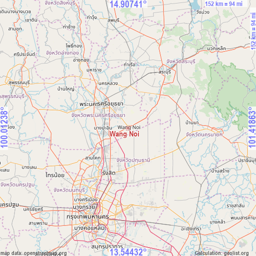
Wang Noi GPS coordinates[2]
14° 13' 36.804" North, 100° 42' 55.8" East
| Map corner | latitude | longitude |
|---|---|---|
| Upper-left | 14.90741°, | 100.01238° |
| Center: | 14.22689°, | 100.7155° |
| Lower-right: | 13.54432°, | 101.41863° |
| Map W x H: | 151.6×151.6 km | = 94.2×94.2mi |
| max Lat: | 20.43353° ⇑62.5% North |
| Wang Noi: | 14.22689° |
| min Lat: | ⇓37.5% South 5.77434° |
| min Long | Wang Noi | max Long |
| 97.93288° | 100.7155° | 105.49506° |
| W 48.8%⇐ | ⇒51.2% E |
Elevation
Elevation of Wang Noi is 5 m = 16 ft, and this is 120.5 m = 395 ft below average elevation for this country.
| Max E: |
1011 m = 3317 ft | 98% |
| Avg. | 125.5 m = 412 ft | |
| Wang Noi | 5 m = 16 ft | |
Min E: |
1 m = 3 ft | 2% |
See also: Thailand elevation on elevation.city.
Geographical zone
Wang Noi is located in North Torrid zone (between Equator and Tropic of Cancer). Distance of this Northern Tropic circle is 1024 km =636.3 mi to North.| Distance of | km | miles | from Wang Noi |
|---|---|---|---|
| North Pole | 8425.2 | 5235.2 | to North |
| Arctic Circle | 5819.3 | 3615.9 | to North |
| Tropic Cancer | 1024 | 636.3 | to North |
| Equator | 1581.9 | 982.9 | to South |


Nearby cities:
15 places around Wang Noi: (largest is in red/bold)
• Ban Bang Kadi Pathum Thani
31 km =19.3 mi,  215°
215°
• Ban Lam Luk Ka
28.5 km =17.7 mi,  166°
166°
• Bang Ban
29.7 km =18.5 mi,  303°
303°
• Bang Pa-in
15 km =9.3 mi,  270°
270°
• Khlong Luang
19.5 km =12.1 mi,  202°
202°
• Nakhon Luang
28.7 km =17.8 mi,  336°
336°
• Nong Khae
20.7 km =12.9 mi,  52°
52°
• Nong Saeng
30.4 km =18.9 mi,  14°
14°
• Nong Suea
15.6 km =9.7 mi,  130°
130°
• Pathum Thani
31 km =19.3 mi, 220°
• Phachi
24.8 km =15.4 mi,  3°
3°
• Phra Nakhon Si Ayutthaya
20.3 km =12.6 mi,  312°
312°
• Sam Khok
27.5 km =17.1 mi,  229°
229°
• Thanyaburi
23 km =14.3 mi, 174°
• Uthai
15.8 km =9.8 mi, 342°
Sources, notices
• [Note1] Compared only with cities in Thailand existing in our database
• [Src1] Map data: © OpenStreetMap contributors (CC-BY-SA)
• [Src2] Other city data from geonames.org with taken over terms of usage.
• [Src3] Geographical zone / Annual Mean Temperature by Robert A. Rohde @ Wikipedia
