Kaset Wisai geodata
Kaset Wisai (Roi Et) is a seat of a second-order administrative division; located in Thailand in Asia/Bangkok (GMT+7) time zone. With population of 18,569 people, there are 170 cities with bigger population in this country. Compared to other cities in Thailand, 60.7% of cities are located further ↓South; 85.6% of cities are located further ←West and 58.5% of cities have lower elevation than Kaset Wisai. Note1


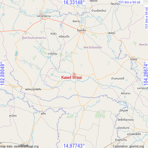
Kaset Wisai GPS coordinates[2]
15° 39' 20.088" North, 103° 35' 0.996" East
| Map corner | latitude | longitude |
|---|---|---|
| Upper-left | 16.33148°, | 102.88049° |
| Center: | 15.65558°, | 103.58361° |
| Lower-right: | 14.97743°, | 104.28674° |
| Map W x H: | 150.6×150.6 km | = 93.6×93.6mi |
| max Lat: | 20.43353° ⇑39.3% North |
| Kaset Wisai: | 15.65558° |
| min Lat: | ⇓60.7% South 5.77434° |
| min Long | Kaset Wisai | max Long |
| 97.93288° | 103.58361° | 105.49506° |
| W 85.6%⇐ | ⇒14.4% E |
Elevation
Elevation of Kaset Wisai is 145 m = 476 ft, and this is 19.5 m = 64 ft above average elevation for this country.
| Max E: |
1011 m = 3317 ft | 41.5% |
| Kaset Wisai | 145 m 476 ft | |
| Avg. | 125.5 m = 412 ft | |
Min E: |
1 m = 3 ft | 58.5% |
See also: Thailand elevation on elevation.city.
Geographical zone
Kaset Wisai is located in North Torrid zone (between Equator and Tropic of Cancer). Distance of this Northern Tropic circle is 865.2 km =537.6 mi to North.| Distance of | km | miles | from Kaset Wisai |
|---|---|---|---|
| North Pole | 8266.3 | 5136.4 | to North |
| Arctic Circle | 5660.4 | 3517.2 | to North |
| Tropic Cancer | 865.2 | 537.6 | to North |
| Equator | 1740.7 | 1081.6 | to South |


Nearby cities:
15 places around Kaset Wisai: (largest is in red/bold)
• At Samat
37.8 km =23.5 mi,  56°
56°
• Chaturaphak Phiman
21.3 km =13.2 mi,  352°
352°
• Chumphon Buri
39.8 km =24.7 mi,  211°
211°
• Kae Dam
46.2 km =28.7 mi,  332°
332°
• Mueang Suang
24.2 km =15 mi,  40°
40°
• Na Dun
38.7 km =24 mi,  280°
280°
• Nong Hi
44.3 km =27.5 mi,  96°
96°
• Pathum Rat
25.8 km =16 mi,  264°
264°
• Phayakkhaphum Phisai
44.5 km =27.7 mi,  249°
249°
• Roi Et
45.2 km =28.1 mi,  9°
9°
• Si Somdet
39.4 km =24.5 mi,  344°
344°
• Suwannaphum
24.1 km =15 mi, 103°
• Tha Tum
38.6 km =24 mi,  165°
165°
• Thawat Buri
46 km =28.6 mi,  22°
22°
• Wapi Pathum
30.6 km =19 mi,  313°
313°
Sources, notices
• [Note1] Compared only with cities in Thailand existing in our database
• [Src1] Map data: © OpenStreetMap contributors (CC-BY-SA)
• [Src2] Other city data from geonames.org with taken over terms of usage.
• [Src3] Geographical zone / Annual Mean Temperature by Robert A. Rohde @ Wikipedia
