Si Racha geodata
Si Racha (Chon Buri) is a seat of a second-order administrative division; located in Thailand in Asia/Bangkok (GMT+7) time zone. With population of 178,916 people, there are 9 cities with bigger population in this country. Compared to other cities in Thailand, 77% of cities are located further ↑North; 53.3% of cities are located further ←West and 78.4% of cities have higher elevation than Si Racha. Note1


Si Racha GPS coordinates[2]
13° 10' 25.392" North, 100° 55' 51.996" East
| Map corner | latitude | longitude |
|---|---|---|
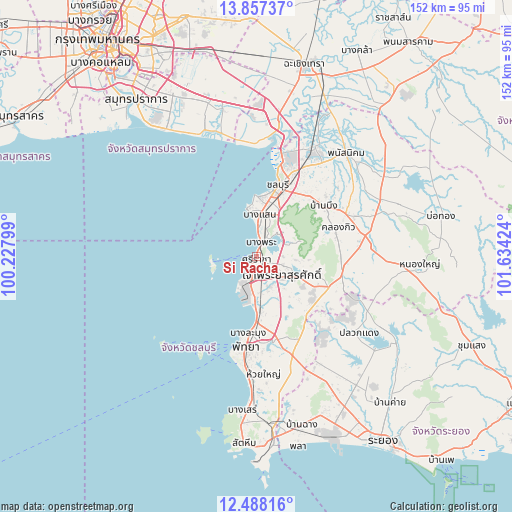
| Upper-left | 13.85737°, | 100.22799° |
| Center: | 13.17372°, | 100.93111° |
| Lower-right: | 12.48816°, | 101.63424° |
| Map W x H: | 152.2×152.2 km | = 94.6×94.6mi |
| max Lat: | 20.43353° ⇑77% North |
| Si Racha: | 13.17372° |
| min Lat: | ⇓23% South 5.77434° |
| min Long | Si Racha | max Long |
| 97.93288° | 100.93111° | 105.49506° |
| W 53.3%⇐ | ⇒46.7% E |
Elevation
Elevation of Si Racha is 13 m = 43 ft, and this is 112.5 m = 369 ft below average elevation for this country.
| Max E: |
1011 m = 3317 ft | 78.4% |
| Avg. | 125.5 m = 412 ft | |
| Si Racha | 13 m = 43 ft | |
Min E: |
1 m = 3 ft | 21.6% |
See also: Si Racha elevation on elevation.city.
Geographical zone
Si Racha is located in North Torrid zone (between Equator and Tropic of Cancer). Distance of this Northern Tropic circle is 1141.1 km =709 mi to North.| Distance of | km | miles | from Si Racha |
|---|---|---|---|
| North Pole | 8542.3 | 5307.9 | to North |
| Arctic Circle | 5936.4 | 3688.7 | to North |
| Tropic Cancer | 1141.1 | 709 | to North |
| Equator | 1464.8 | 910.2 | to South |


Nearby cities:
15 places around Si Racha: (largest is in red/bold)
• Ban Bueng
24.8 km =15.4 mi,  52°
52°
• Ban Ko Lan
31.8 km =19.8 mi,  209°
209°
• Ban Talat Bueng
13.8 km =8.6 mi,  145°
145°
• Bang Bo
45.7 km =28.4 mi,  346°
346°
• Bang Bo District
47.2 km =29.3 mi,  344°
344°
• Bang Lamung
14.1 km =8.8 mi,  180°
180°
• Bang Pakong
41.6 km =25.8 mi,  9°
9°
• Chon Buri
21.7 km =13.5 mi,  15°
15°
• Ko Si Chang
13.6 km =8.5 mi,  265°
265°
• Na Kluea
23.8 km =14.8 mi,  188°
188°
• Nong Yai
47.8 km =29.7 mi,  92°
92°
• Pattaya
27.2 km =16.9 mi, 190°
• Phan Thong
37.2 km =23.1 mi,  28°
28°
• Phanat Nikhom
40.8 km =25.4 mi,  42°
42°
• Pluak Daeng
38.1 km =23.7 mi,  126°
126°
Sources, notices
• [Note1] Compared only with cities in Thailand existing in our database
• [Src1] Map data: © OpenStreetMap contributors (CC-BY-SA)
• [Src2] Other city data from geonames.org with taken over terms of usage.
• [Src3] Geographical zone / Annual Mean Temperature by Robert A. Rohde @ Wikipedia
