Bang Bo geodata
Bang Bo (Samut Prakan) is a seat of a second-order administrative division; located in Thailand in Asia/Bangkok (GMT+7) time zone. In our database, there are 331 cities with bigger population. Compared to other cities in Thailand, 74.5% of cities are located further ↑North; 51.6% of cities are located further ←West and 99.8% of cities have higher elevation than Bang Bo. Note1


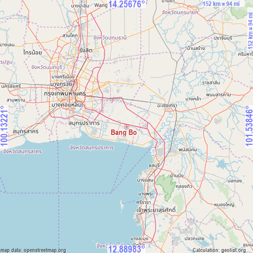
Bang Bo GPS coordinates[2]
13° 34' 27.408" North, 100° 50' 7.188" East
| Map corner | latitude | longitude |
|---|---|---|
| Upper-left | 14.25676°, | 100.13221° |
| Center: | 13.57428°, | 100.83533° |
| Lower-right: | 12.88983°, | 101.53846° |
| Map W x H: | 152×152 km | = 94.4×94.4mi |
| max Lat: | 20.43353° ⇑74.5% North |
| Bang Bo: | 13.57428° |
| min Lat: | ⇓25.5% South 5.77434° |
| min Long | Bang Bo | max Long |
| 97.93288° | 100.83533° | 105.49506° |
| W 51.6%⇐ | ⇒48.4% E |
Elevation
Elevation of Bang Bo is 3 m = 10 ft, and this is 122.5 m = 402 ft below average elevation for this country.
| Max E: |
1011 m = 3317 ft | 99.8% |
| Avg. | 125.5 m = 412 ft | |
| Bang Bo | 3 m = 10 ft | |
Min E: |
1 m = 3 ft | 0.2% |
See also: Thailand elevation on elevation.city.
Geographical zone
Bang Bo is located in North Torrid zone (between Equator and Tropic of Cancer). Distance of this Northern Tropic circle is 1096.6 km =681.4 mi to North.| Distance of | km | miles | from Bang Bo |
|---|---|---|---|
| North Pole | 8497.7 | 5280.2 | to North |
| Arctic Circle | 5891.9 | 3661.1 | to North |
| Tropic Cancer | 1096.6 | 681.4 | to North |
| Equator | 1509.3 | 937.8 | to South |


Nearby cities:
15 places around Bang Bo: (largest is in red/bold)
• Ban Khlong Bang Sao Thong
7.5 km =4.7 mi,  357°
357°
• Ban Pho
26.5 km =16.5 mi,  84°
84°
• Bang Bo District
2.3 km =1.4 mi,  296°
296°
• Bang Na
23.3 km =14.5 mi, 296°
• Bang Pakong
17.4 km =10.8 mi,  101°
101°
• Bang Sao Thong
2.4 km =1.5 mi,  347°
347°
• Chachoengsao
28.5 km =17.7 mi,  63°
63°
• Chon Buri
28.5 km =17.7 mi,  145°
145°
• Lat Krabang
17.5 km =10.9 mi,  341°
341°
• Min Buri
28.9 km =18 mi, 337°
• Phra Khanong
29 km =18 mi, 299°
• Phra Samut Chedi
28.6 km =17.8 mi,  276°
276°
• Samut Prakan
25.9 km =16.1 mi, 276°
• Saphan Sung
27.2 km =16.9 mi,  323°
323°
• Suan Luang
26.4 km =16.4 mi,  311°
311°
Sources, notices
• [Note1] Compared only with cities in Thailand existing in our database
• [Src1] Map data: © OpenStreetMap contributors (CC-BY-SA)
• [Src2] Other city data from geonames.org with taken over terms of usage.
• [Src3] Geographical zone / Annual Mean Temperature by Robert A. Rohde @ Wikipedia
