Dok Kham Tai geodata
Dok Kham Tai (Phayao) is a seat of a second-order administrative division; located in Thailand in Asia/Bangkok (GMT+7) time zone. With population of 23,824 people, there are 134 cities with bigger population in this country. Compared to other cities in Thailand, 95.8% of cities are located further ↓South; 72.6% of cities are located further →East and 95.2% of cities have lower elevation than Dok Kham Tai. Note1


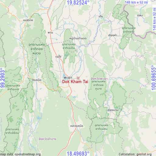
Dok Kham Tai GPS coordinates[2]
19° 9' 44.712" North, 99° 59' 36.312" East
| Map corner | latitude | longitude |
|---|---|---|
| Upper-left | 19.82524°, | 99.2903° |
| Center: | 19.16242°, | 99.99342° |
| Lower-right: | 18.49693°, | 100.69655° |
| Map W x H: | 147.7×147.7 km | = 91.8×91.8mi |
| max Lat: | 20.43353° ⇑4.2% North |
| Dok Kham Tai: | 19.16242° |
| min Lat: | ⇓95.8% South 5.77434° |
| min Long | Dok Kham Tai | max Long |
| 97.93288° | 99.99342° | 105.49506° |
| W 27.4%⇐ | ⇒72.6% E |
Elevation
Elevation of Dok Kham Tai is 394 m = 1293 ft, and this is 268.5 m = 881 ft above average elevation for this country.
| Max E: |
1011 m = 3317 ft | 4.8% |
| Dok Kham Tai | 394 m 1293 ft | |
| Avg. | 125.5 m = 412 ft | |
Min E: |
1 m = 3 ft | 95.2% |
See also: Thailand elevation on elevation.city.
Geographical zone
Dok Kham Tai is located in North Torrid zone (between Equator and Tropic of Cancer). Distance of this Northern Tropic circle is 475.3 km =295.3 mi to North.| Distance of | km | miles | from Dok Kham Tai |
|---|---|---|---|
| North Pole | 7876.4 | 4894.2 | to North |
| Arctic Circle | 5270.5 | 3274.9 | to North |
| Tropic Cancer | 475.3 | 295.3 | to North |
| Equator | 2130.7 | 1324 | to South |


Nearby cities:
15 places around Dok Kham Tai: (largest is in red/bold)
• Ban Luang
58.2 km =36.2 mi,  126°
126°
• Chiang Kham
51.4 km =31.9 mi,  38°
38°
• Chiang Muan
44.7 km =27.8 mi, 132°
• Chun
24.4 km =15.2 mi, 37°
• Mae Chai
27.8 km =17.3 mi,  317°
317°
• Ngao
45.1 km =28 mi,  182°
182°
• Pa Daet
38.1 km =23.7 mi,  359°
359°
• Phan
51 km =31.7 mi,  328°
328°
• Phayao
12.5 km =7.8 mi,  285°
285°
• Phu Kam Yao
12.3 km =7.6 mi,  348°
348°
• Phu Sang
59.7 km =37.1 mi, 35°
• Pong
29.6 km =18.4 mi,  92°
92°
• Thoeng
61.8 km =38.4 mi,  19°
19°
• Wang Nuea
39.3 km =24.4 mi,  267°
267°
• Wiang Pa Pao
55 km =34.2 mi, 291°
Sources, notices
• [Note1] Compared only with cities in Thailand existing in our database
• [Src1] Map data: © OpenStreetMap contributors (CC-BY-SA)
• [Src2] Other city data from geonames.org with taken over terms of usage.
• [Src3] Geographical zone / Annual Mean Temperature by Robert A. Rohde @ Wikipedia
