Lop Buri geodata
Lop Buri is a seat of a first-order administrative division; located in Thailand in Asia/Bangkok (GMT+7) time zone. With population of 57,761 people, there are 43 cities with bigger population in this country. Compared to other cities in Thailand, 53% of cities are located further ↑North; 52.5% of cities are located further →East and 71.3% of cities have higher elevation than Lop Buri. Note1


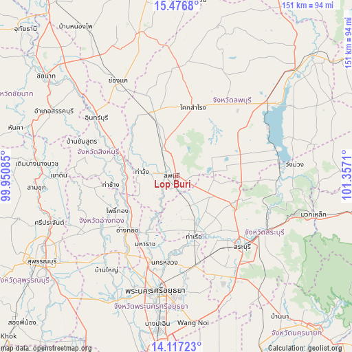
Lop Buri GPS coordinates[2]
14° 47' 53.088" North, 100° 39' 14.292" East
| Map corner | latitude | longitude |
|---|---|---|
| Upper-left | 15.4768°, | 99.95085° |
| Center: | 14.79808°, | 100.65397° |
| Lower-right: | 14.11723°, | 101.3571° |
| Map W x H: | 151.2×151.2 km | = 94×94mi |
| max Lat: | 20.43353° ⇑53% North |
| Lop Buri: | 14.79808° |
| min Lat: | ⇓47% South 5.77434° |
| min Long | Lop Buri | max Long |
| 97.93288° | 100.65397° | 105.49506° |
| W 47.5%⇐ | ⇒52.5% E |
Elevation
Elevation of Lop Buri is 20 m = 66 ft, and this is 105.5 m = 346 ft below average elevation for this country.
| Max E: |
1011 m = 3317 ft | 71.3% |
| Avg. | 125.5 m = 412 ft | |
| Lop Buri | 20 m = 66 ft | |
Min E: |
1 m = 3 ft | 28.7% |
See also: Lop Buri elevation on elevation.city.
Geographical zone
Lop Buri is located in North Torrid zone (between Equator and Tropic of Cancer). Distance of this Northern Tropic circle is 960.5 km =596.8 mi to North.| Distance of | km | miles | from Lop Buri |
|---|---|---|---|
| North Pole | 8361.7 | 5195.7 | to North |
| Arctic Circle | 5755.8 | 3576.5 | to North |
| Tropic Cancer | 960.5 | 596.8 | to North |
| Equator | 1645.4 | 1022.4 | to South |


Nearby cities:
15 places around Lop Buri: (largest is in red/bold)
• Ban Mi
30.1 km =18.7 mi,  335°
335°
• Ban Mo
21.8 km =13.5 mi,  158°
158°
• Ban Phraek
18.8 km =11.7 mi,  206°
206°
• Ban Thai Tan
26.6 km =16.5 mi,  222°
222°
• Chaiyo
24.1 km =15 mi,  235°
235°
• Chaiyo
25.1 km =15.6 mi,  228°
228°
• Don Phut
23.1 km =14.4 mi,  186°
186°
• Nong Don
13.9 km =8.6 mi,  154°
154°
• Pho Thong
30.1 km =18.7 mi, 241°
• Phra Phutthabat
17.2 km =10.7 mi,  118°
118°
• Phrom Buri
21.6 km =13.4 mi,  267°
267°
• Sing Buri
28.6 km =17.8 mi,  290°
290°
• Tha Chang
28.7 km =17.8 mi,  261°
261°
• Tha Ruea
26.8 km =16.7 mi, 163°
• Tha Wung
16.3 km =10.1 mi,  275°
275°
Sources, notices
• [Note1] Compared only with cities in Thailand existing in our database
• [Src1] Map data: © OpenStreetMap contributors (CC-BY-SA)
• [Src2] Other city data from geonames.org with taken over terms of usage.
• [Src3] Geographical zone / Annual Mean Temperature by Robert A. Rohde @ Wikipedia
