Lam Luk Ka geodata
Lam Luk Ka (Pathum Thani) is a seat of a second-order administrative division; located in Thailand in Asia/Bangkok (GMT+7) time zone. In our database, there are 331 cities with bigger population. Compared to other cities in Thailand, 65.6% of cities are located further ↑North; 50.2% of cities are located further →East and 91.2% of cities have higher elevation than Lam Luk Ka. Note1


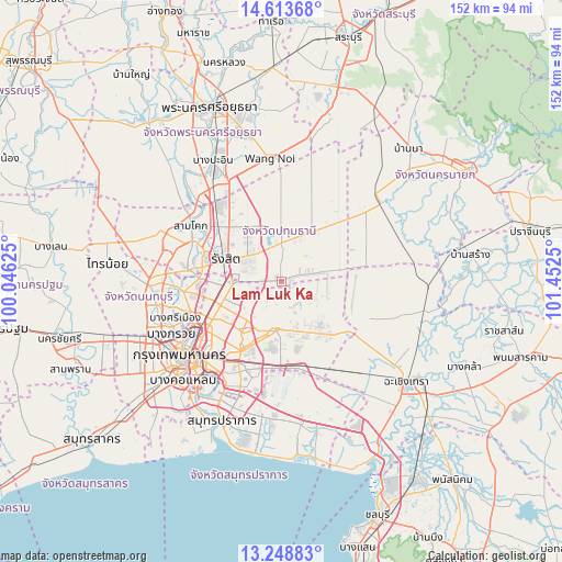
Lam Luk Ka GPS coordinates[2]
13° 55' 56.136" North, 100° 44' 57.732" East
| Map corner | latitude | longitude |
|---|---|---|
| Upper-left | 14.61368°, | 100.04625° |
| Center: | 13.93226°, | 100.74937° |
| Lower-right: | 13.24883°, | 101.4525° |
| Map W x H: | 151.8×151.8 km | = 94.3×94.3mi |
| max Lat: | 20.43353° ⇑65.6% North |
| Lam Luk Ka: | 13.93226° |
| min Lat: | ⇓34.4% South 5.77434° |
| min Long | Lam Luk Ka | max Long |
| 97.93288° | 100.74937° | 105.49506° |
| W 49.8%⇐ | ⇒50.2% E |
Elevation
Elevation of Lam Luk Ka is 8 m = 26 ft, and this is 117.5 m = 385 ft below average elevation for this country.
| Max E: |
1011 m = 3317 ft | 91.2% |
| Avg. | 125.5 m = 412 ft | |
| Lam Luk Ka | 8 m = 26 ft | |
Min E: |
1 m = 3 ft | 8.8% |
See also: Thailand elevation on elevation.city.
Geographical zone
Lam Luk Ka is located in North Torrid zone (between Equator and Tropic of Cancer). Distance of this Northern Tropic circle is 1056.8 km =656.7 mi to North.| Distance of | km | miles | from Lam Luk Ka |
|---|---|---|---|
| North Pole | 8457.9 | 5255.5 | to North |
| Arctic Circle | 5852.1 | 3636.3 | to North |
| Tropic Cancer | 1056.8 | 656.7 | to North |
| Equator | 1549.1 | 962.6 | to South |


Nearby cities:
15 places around Lam Luk Ka: (largest is in red/bold)
• Ban Bang Kadi Pathum Thani
22.8 km =14.2 mi,  289°
289°
• Ban Lam Luk Ka
5.9 km =3.7 mi,  31°
31°
• Bang Kapi
21.6 km =13.4 mi,  210°
210°
• Bueng Kum
18.5 km =11.5 mi, 207°
• Don Mueang
17.3 km =10.7 mi,  263°
263°
• Khan Na Yao
14 km =8.7 mi, 212°
• Khlong Luang
18.5 km =11.5 mi,  322°
322°
• Khlong Sam Wa
10.8 km =6.7 mi,  188°
188°
• Lat Phrao
21 km =13 mi,  226°
226°
• Min Buri
13.3 km =8.3 mi, 188°
• Nong Chok
14.8 km =9.2 mi,  124°
124°
• Sai Mai
11.3 km =7 mi, 263°
• Saphan Sung
19.3 km =12 mi,  200°
200°
• Thanyaburi
10 km =6.2 mi,  350°
350°
• Wang Thonglang
22.1 km =13.7 mi,  222°
222°
Sources, notices
• [Note1] Compared only with cities in Thailand existing in our database
• [Src1] Map data: © OpenStreetMap contributors (CC-BY-SA)
• [Src2] Other city data from geonames.org with taken over terms of usage.
• [Src3] Geographical zone / Annual Mean Temperature by Robert A. Rohde @ Wikipedia
