Ranot geodata
Ranot (Songkhla) is a seat of a second-order administrative division; located in Thailand in Asia/Bangkok (GMT+7) time zone. With population of 19,780 people, there are 159 cities with bigger population in this country. Compared to other cities in Thailand, 91.6% of cities are located further ↑North; 63.9% of cities are located further →East and 94.4% of cities have higher elevation than Ranot. Note1


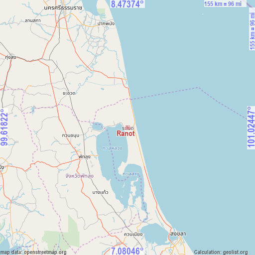
Ranot GPS coordinates[2]
7° 46' 39.648" North, 100° 19' 16.824" East
| Map corner | latitude | longitude |
|---|---|---|
| Upper-left | 8.47374°, | 99.61822° |
| Center: | 7.77768°, | 100.32134° |
| Lower-right: | 7.08046°, | 101.02447° |
| Map W x H: | 154.9×154.9 km | = 96.3×96.3mi |
| max Lat: | 20.43353° ⇑91.6% North |
| Ranot: | 7.77768° |
| min Lat: | ⇓8.4% South 5.77434° |
| min Long | Ranot | max Long |
| 97.93288° | 100.32134° | 105.49506° |
| W 36.1%⇐ | ⇒63.9% E |
Elevation
Elevation of Ranot is 7 m = 23 ft, and this is 118.5 m = 389 ft below average elevation for this country.
| Max E: |
1011 m = 3317 ft | 94.4% |
| Avg. | 125.5 m = 412 ft | |
| Ranot | 7 m = 23 ft | |
Min E: |
1 m = 3 ft | 5.6% |
See also: Thailand elevation on elevation.city.
Geographical zone
Ranot is located in North Torrid zone (between Equator and Tropic of Cancer). Distance of Equator is 864.8 km =537.4 mi to South.| Distance of | km | miles | from Ranot |
|---|---|---|---|
| North Pole | 9142.3 | 5680.8 | to North |
| Arctic Circle | 6536.4 | 4061.5 | to North |
| Tropic Cancer | 1741.1 | 1081.9 | to North |
| Equator | 864.8 | 537.4 | to South |


Nearby cities:
15 places around Ranot: (largest is in red/bold)
• Bang Kaeo
41.8 km =26 mi,  202°
202°
• Cha-uat
41.2 km =25.6 mi,  300°
300°
• Chaloem Phra Kiat
54.4 km =33.8 mi,  324°
324°
• Chian Yai
47.7 km =29.6 mi,  335°
335°
• Hua Sai
29.7 km =18.5 mi,  356°
356°
• Khao Chaison
40.8 km =25.4 mi,  210°
210°
• Khuan Khanun
34.7 km =21.6 mi,  262°
262°
• Krasae Sin
18.1 km =11.2 mi,  177°
177°
• Pa Phayom
45 km =28 mi,  278°
278°
• Pak Phayun
48.4 km =30.1 mi, 180°
• Phatthalung
32.2 km =20 mi,  236°
236°
• Sathing Phra
36.3 km =22.6 mi,  159°
159°
• Si Banphot
48.6 km =30.2 mi, 262°
• Srinagarindra
47.6 km =29.6 mi, 240°
• Tamot
54 km =33.6 mi, 205°
Sources, notices
• [Note1] Compared only with cities in Thailand existing in our database
• [Src1] Map data: © OpenStreetMap contributors (CC-BY-SA)
• [Src2] Other city data from geonames.org with taken over terms of usage.
• [Src3] Geographical zone / Annual Mean Temperature by Robert A. Rohde @ Wikipedia
