Chiang Khan geodata
Chiang Khan (Loei) is a seat of a second-order administrative division; located in Thailand in Asia/Bangkok (GMT+7) time zone. In our database, there are 331 cities with bigger population. Compared to other cities in Thailand, 87.7% of cities are located further ↓South; 62.6% of cities are located further ←West and 85.1% of cities have lower elevation than Chiang Khan. Note1


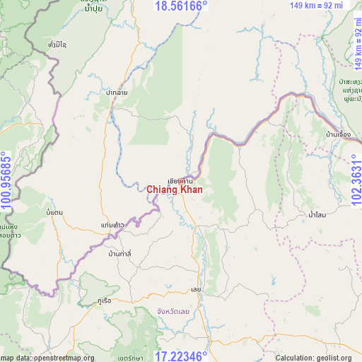
Chiang Khan GPS coordinates[2]
17° 53' 37.752" North, 101° 39' 35.892" East
| Map corner | latitude | longitude |
|---|---|---|
| Upper-left | 18.56166°, | 100.95685° |
| Center: | 17.89382°, | 101.65997° |
| Lower-right: | 17.22346°, | 102.3631° |
| Map W x H: | 148.8×148.8 km | = 92.5×92.5mi |
| max Lat: | 20.43353° ⇑12.3% North |
| Chiang Khan: | 17.89382° |
| min Lat: | ⇓87.7% South 5.77434° |
| min Long | Chiang Khan | max Long |
| 97.93288° | 101.65997° | 105.49506° |
| W 62.6%⇐ | ⇒37.4% E |
Elevation
Elevation of Chiang Khan is 218 m = 715 ft, and this is 92.5 m = 303 ft above average elevation for this country.
| Max E: |
1011 m = 3317 ft | 14.9% |
| Chiang Khan | 218 m 715 ft | |
| Avg. | 125.5 m = 412 ft | |
Min E: |
1 m = 3 ft | 85.1% |
See also: Thailand elevation on elevation.city.
Geographical zone
Chiang Khan is located in North Torrid zone (between Equator and Tropic of Cancer). Distance of this Northern Tropic circle is 616.3 km =383 mi to North.| Distance of | km | miles | from Chiang Khan |
|---|---|---|---|
| North Pole | 8017.5 | 4981.8 | to North |
| Arctic Circle | 5411.6 | 3362.6 | to North |
| Tropic Cancer | 616.3 | 383 | to North |
| Equator | 1989.6 | 1236.3 | to South |


Nearby cities:
15 places around Chiang Khan: (largest is in red/bold)
• Ban Khok
64.3 km =40 mi,  283°
283°
• Erawan
72.8 km =45.2 mi,  154°
154°
• Loei
45.4 km =28.2 mi,  170°
170°
• Na Haeo
77.4 km =48.1 mi,  234°
234°
• Na Wang
77.3 km =48 mi,  144°
144°
• Na Yung
51.8 km =32.2 mi,  89°
89°
• Nam Som
57.7 km =35.9 mi,  103°
103°
• Pak Chom
28.9 km =18 mi,  60°
60°
• Pho Tak
78.8 km =49 mi, 91°
• Phu Ruea
58.2 km =36.2 mi,  212°
212°
• Sangkhom
67.6 km =42 mi,  73°
73°
• Suwanna Khuha
75.3 km =46.8 mi,  119°
119°
• Suwannakhuha
75.3 km =46.8 mi, 119°
• Tha Li
39.3 km =24.4 mi,  220°
220°
• Wang Saphung
66.9 km =41.6 mi, 170°
Sources, notices
• [Note1] Compared only with cities in Thailand existing in our database
• [Src1] Map data: © OpenStreetMap contributors (CC-BY-SA)
• [Src2] Other city data from geonames.org with taken over terms of usage.
• [Src3] Geographical zone / Annual Mean Temperature by Robert A. Rohde @ Wikipedia
