Na Yung geodata
Na Yung (Changwat Udon Thani) is a seat of a second-order administrative division; located in Thailand in Asia/Bangkok (GMT+7) time zone. In our database, there are 331 cities with bigger population. Compared to other cities in Thailand, 87.8% of cities are located further ↓South; 68.5% of cities are located further ←West and 87% of cities have lower elevation than Na Yung. Note1


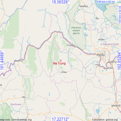
Na Yung GPS coordinates[2]
17° 53' 50.892" North, 102° 8' 59.316" East
| Map corner | latitude | longitude |
|---|---|---|
| Upper-left | 18.56529°, | 101.44669° |
| Center: | 17.89747°, | 102.14981° |
| Lower-right: | 17.22712°, | 102.85294° |
| Map W x H: | 148.8×148.8 km | = 92.5×92.5mi |
| max Lat: | 20.43353° ⇑12.2% North |
| Na Yung: | 17.89747° |
| min Lat: | ⇓87.8% South 5.77434° |
| min Long | Na Yung | max Long |
| 97.93288° | 102.14981° | 105.49506° |
| W 68.5%⇐ | ⇒31.5% E |
Elevation
Elevation of Na Yung is 233 m = 764 ft, and this is 107.5 m = 353 ft above average elevation for this country.
| Max E: |
1011 m = 3317 ft | 13% |
| Na Yung | 233 m 764 ft | |
| Avg. | 125.5 m = 412 ft | |
Min E: |
1 m = 3 ft | 87% |
See also: Thailand elevation on elevation.city.
Geographical zone
Na Yung is located in North Torrid zone (between Equator and Tropic of Cancer). Distance of this Northern Tropic circle is 615.9 km =382.7 mi to North.| Distance of | km | miles | from Na Yung |
|---|---|---|---|
| North Pole | 8017 | 4981.5 | to North |
| Arctic Circle | 5411.2 | 3362.4 | to North |
| Tropic Cancer | 615.9 | 382.7 | to North |
| Equator | 1990 | 1236.5 | to South |


Nearby cities:
15 places around Na Yung: (largest is in red/bold)
• Ban Phue
41.9 km =26 mi,  123°
123°
• Chiang Khan
51.8 km =32.2 mi,  269°
269°
• Loei
63.6 km =39.5 mi,  224°
224°
• Na Klang
65.8 km =40.9 mi,  176°
176°
• Na Wang
64.2 km =39.9 mi,  186°
186°
• Nam Som
14.7 km =9.1 mi,  163°
163°
• Nong Khai
62.7 km =39 mi,  91°
91°
• Pak Chom
29.9 km =18.6 mi,  297°
297°
• Pho Tak
27 km =16.8 mi,  95°
95°
• Sa Khrai
68.2 km =42.4 mi,  111°
111°
• Sangkhom
22.7 km =14.1 mi,  35°
35°
• Si Chiang Mai
46.7 km =29 mi,  81°
81°
• Suwanna Khuha
39.7 km =24.7 mi, 159°
• Suwannakhuha
39.7 km =24.7 mi, 159°
• Tha Bo
46 km =28.6 mi, 96°
Sources, notices
• [Note1] Compared only with cities in Thailand existing in our database
• [Src1] Map data: © OpenStreetMap contributors (CC-BY-SA)
• [Src2] Other city data from geonames.org with taken over terms of usage.
• [Src3] Geographical zone / Annual Mean Temperature by Robert A. Rohde @ Wikipedia
