Phu Ruea geodata
Phu Ruea (Loei) is a seat of a second-order administrative division; located in Thailand in Asia/Bangkok (GMT+7) time zone. In our database, there are 331 cities with bigger population. Compared to other cities in Thailand, 83.5% of cities are located further ↓South; 59.6% of cities are located further ←West and 99% of cities have lower elevation than Phu Ruea. Note1


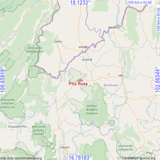
Phu Ruea GPS coordinates[2]
17° 27' 13.68" North, 101° 21' 44.316" East
| Map corner | latitude | longitude |
|---|---|---|
| Upper-left | 18.1233°, | 100.65919° |
| Center: | 17.4538°, | 101.36231° |
| Lower-right: | 16.78183°, | 102.06544° |
| Map W x H: | 149.2×149.2 km | = 92.7×92.7mi |
| max Lat: | 20.43353° ⇑16.5% North |
| Phu Ruea: | 17.4538° |
| min Lat: | ⇓83.5% South 5.77434° |
| min Long | Phu Ruea | max Long |
| 97.93288° | 101.36231° | 105.49506° |
| W 59.6%⇐ | ⇒40.4% E |
Elevation
Elevation of Phu Ruea is 632 m = 2073 ft, and this is 506.5 m = 1662 ft above average elevation for this country.
| Max E: |
1011 m = 3317 ft | 1% |
| Phu Ruea | 632 m 2073 ft | |
| Avg. | 125.5 m = 412 ft | |
Min E: |
1 m = 3 ft | 99% |
See also: Thailand elevation on elevation.city.
Geographical zone
Phu Ruea is located in North Torrid zone (between Equator and Tropic of Cancer). Distance of this Northern Tropic circle is 665.2 km =413.3 mi to North.| Distance of | km | miles | from Phu Ruea |
|---|---|---|---|
| North Pole | 8066.4 | 5012.2 | to North |
| Arctic Circle | 5460.5 | 3393 | to North |
| Tropic Cancer | 665.2 | 413.3 | to North |
| Equator | 1940.7 | 1205.9 | to South |


Nearby cities:
15 places around Phu Ruea: (largest is in red/bold)
• Ban Khok
70.9 km =44.1 mi,  333°
333°
• Chiang Khan
58.2 km =36.2 mi,  32°
32°
• Dan Sai
29.9 km =18.6 mi,  229°
229°
• Erawan
65 km =40.4 mi,  105°
105°
• Loei
38.9 km =24.2 mi,  83°
83°
• Lom Kao
64.7 km =40.2 mi,  192°
192°
• Lom Sak
76 km =47.2 mi, 189°
• Na Haeo
31.4 km =19.5 mi,  276°
276°
• Na Wang
77.3 km =48 mi,  100°
100°
• Nakhon Thai
68.2 km =42.4 mi, 234°
• Nam Pat
78.1 km =48.5 mi,  292°
292°
• Nong Hin
64.2 km =39.9 mi,  124°
124°
• Phu Luang
47.4 km =29.5 mi,  137°
137°
• Tha Li
19.9 km =12.4 mi,  18°
18°
• Wang Saphung
46.3 km =28.8 mi, 111°
Sources, notices
• [Note1] Compared only with cities in Thailand existing in our database
• [Src1] Map data: © OpenStreetMap contributors (CC-BY-SA)
• [Src2] Other city data from geonames.org with taken over terms of usage.
• [Src3] Geographical zone / Annual Mean Temperature by Robert A. Rohde @ Wikipedia
