Khlong Khuean geodata
Khlong Khuean (Chachoengsao) is a seat of a second-order administrative division; located in Thailand in Asia/Bangkok (GMT+7) time zone. With population of 3,703 people, there are 318 cities with bigger population in this country. Compared to other cities in Thailand, 68.3% of cities are located further ↑North; 57% of cities are located further ←West and 99.3% of cities have higher elevation than Khlong Khuean. Note1


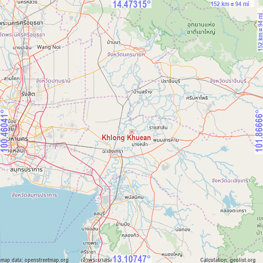
Khlong Khuean GPS coordinates[2]
13° 47' 28.716" North, 101° 9' 48.708" East
| Map corner | latitude | longitude |
|---|---|---|
| Upper-left | 14.47315°, | 100.46041° |
| Center: | 13.79131°, | 101.16353° |
| Lower-right: | 13.10747°, | 101.86666° |
| Map W x H: | 151.8×151.9 km | = 94.3×94.4mi |
| max Lat: | 20.43353° ⇑68.3% North |
| Khlong Khuean: | 13.79131° |
| min Lat: | ⇓31.7% South 5.77434° |
| min Long | Khlong Khuean | max Long |
| 97.93288° | 101.16353° | 105.49506° |
| W 57%⇐ | ⇒43% E |
Elevation
Elevation of Khlong Khuean is 4 m = 13 ft, and this is 121.5 m = 399 ft below average elevation for this country.
| Max E: |
1011 m = 3317 ft | 99.3% |
| Avg. | 125.5 m = 412 ft | |
| Khlong Khuean | 4 m = 13 ft | |
Min E: |
1 m = 3 ft | 0.7% |
See also: Thailand elevation on elevation.city.
Geographical zone
Khlong Khuean is located in North Torrid zone (between Equator and Tropic of Cancer). Distance of this Northern Tropic circle is 1072.5 km =666.4 mi to North.| Distance of | km | miles | from Khlong Khuean |
|---|---|---|---|
| North Pole | 8473.6 | 5265.2 | to North |
| Arctic Circle | 5867.7 | 3646 | to North |
| Tropic Cancer | 1072.5 | 666.4 | to North |
| Equator | 1533.4 | 952.8 | to South |


Nearby cities:
15 places around Khlong Khuean: (largest is in red/bold)
• Ban Pho
23.3 km =14.5 mi,  202°
202°
• Ban Sang
23.5 km =14.6 mi,  15°
15°
• Bang Khla
9.1 km =5.7 mi,  148°
148°
• Bang Nam Priao
13.5 km =8.4 mi,  297°
297°
• Bang Pakong
33.2 km =20.6 mi,  213°
213°
• Chachoengsao
15.2 km =9.4 mi,  220°
220°
• Nong Chok
33.3 km =20.7 mi,  282°
282°
• Phan Thong
36.7 km =22.8 mi,  191°
191°
• Phanat Nikhom
38.5 km =23.9 mi,  176°
176°
• Phanom Sarakham
20.6 km =12.8 mi,  103°
103°
• Plaeng Yao
26.4 km =16.4 mi, 150°
• Prachin Buri
36.3 km =22.6 mi,  37°
37°
• Ratchasan
12.8 km =8 mi,  94°
94°
• Sanam Chai Khet
33.2 km =20.6 mi,  116°
116°
• Si Mahosot
28.2 km =17.5 mi,  67°
67°
Sources, notices
• [Note1] Compared only with cities in Thailand existing in our database
• [Src1] Map data: © OpenStreetMap contributors (CC-BY-SA)
• [Src2] Other city data from geonames.org with taken over terms of usage.
• [Src3] Geographical zone / Annual Mean Temperature by Robert A. Rohde @ Wikipedia
