Bang Len geodata
Bang Len (Nakhon Pathom) is a seat of a second-order administrative division; located in Thailand in Asia/Bangkok (GMT+7) time zone. With population of 17,914 people, there are 177 cities with bigger population in this country. Compared to other cities in Thailand, 64.2% of cities are located further ↑North; 67.1% of cities are located further →East and 94.4% of cities have higher elevation than Bang Len. Note1


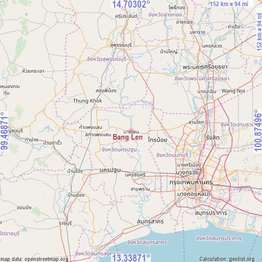
Bang Len GPS coordinates[2]
14° 1' 18.768" North, 100° 10' 18.588" East
| Map corner | latitude | longitude |
|---|---|---|
| Upper-left | 14.70302°, | 99.46871° |
| Center: | 14.02188°, | 100.17183° |
| Lower-right: | 13.33871°, | 100.87496° |
| Map W x H: | 151.7×151.7 km | = 94.3×94.3mi |
| max Lat: | 20.43353° ⇑64.2% North |
| Bang Len: | 14.02188° |
| min Lat: | ⇓35.8% South 5.77434° |
| min Long | Bang Len | max Long |
| 97.93288° | 100.17183° | 105.49506° |
| W 32.9%⇐ | ⇒67.1% E |
Elevation
Elevation of Bang Len is 7 m = 23 ft, and this is 118.5 m = 389 ft below average elevation for this country.
| Max E: |
1011 m = 3317 ft | 94.4% |
| Avg. | 125.5 m = 412 ft | |
| Bang Len | 7 m = 23 ft | |
Min E: |
1 m = 3 ft | 5.6% |
See also: Thailand elevation on elevation.city.
Geographical zone
Bang Len is located in North Torrid zone (between Equator and Tropic of Cancer). Distance of this Northern Tropic circle is 1046.8 km =650.5 mi to North.| Distance of | km | miles | from Bang Len |
|---|---|---|---|
| North Pole | 8448 | 5249.3 | to North |
| Arctic Circle | 5842.1 | 3630.1 | to North |
| Tropic Cancer | 1046.8 | 650.5 | to North |
| Equator | 1559.1 | 968.8 | to South |


Nearby cities:
15 places around Bang Len: (largest is in red/bold)
• Bang Bua Thong
29.6 km =18.4 mi,  113°
113°
• Bang Sai
37.5 km =23.3 mi,  22°
22°
• Bang Yai
28.6 km =17.8 mi,  133°
133°
• Don Tum
12.1 km =7.5 mi,  235°
235°
• Kamphaeng Saen
19.8 km =12.3 mi,  262°
262°
• Lat Bua Luang
21.7 km =13.5 mi,  42°
42°
• Lat Lum Kaeo
25.2 km =15.7 mi,  86°
86°
• Nakhon Chai Si
24.6 km =15.3 mi,  176°
176°
• Nakhon Pathom
26.4 km =16.4 mi,  211°
211°
• Pak Kret
37.3 km =23.2 mi, 108°
• Sai Noi
15.9 km =9.9 mi, 107°
• Salaya
29.3 km =18.2 mi,  146°
146°
• Sam Phran
33.1 km =20.6 mi,  171°
171°
• Song Phi Nong
27.8 km =17.3 mi,  324°
324°
• Thawi Watthana
31.3 km =19.4 mi, 146°
Sources, notices
• [Note1] Compared only with cities in Thailand existing in our database
• [Src1] Map data: © OpenStreetMap contributors (CC-BY-SA)
• [Src2] Other city data from geonames.org with taken over terms of usage.
• [Src3] Geographical zone / Annual Mean Temperature by Robert A. Rohde @ Wikipedia
