Kamphaeng Saen geodata
Kamphaeng Saen (Nakhon Pathom) is a seat of a second-order administrative division; located in Thailand in Asia/Bangkok (GMT+7) time zone. In our database, there are 331 cities with bigger population. Compared to other cities in Thailand, 64.7% of cities are located further ↑North; 72.8% of cities are located further →East and 88.1% of cities have higher elevation than Kamphaeng Saen. Note1


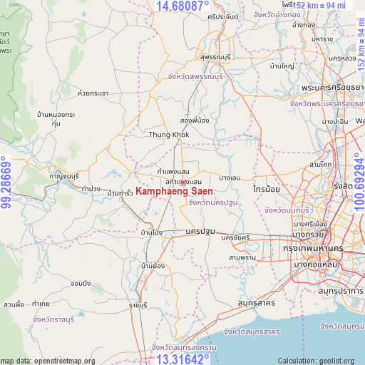
Kamphaeng Saen GPS coordinates[2]
13° 59' 58.776" North, 99° 59' 23.316" East
| Map corner | latitude | longitude |
|---|---|---|
| Upper-left | 14.68087°, | 99.28669° |
| Center: | 13.99966°, | 99.98981° |
| Lower-right: | 13.31642°, | 100.69294° |
| Map W x H: | 151.7×151.7 km | = 94.3×94.3mi |
| max Lat: | 20.43353° ⇑64.7% North |
| Kamphaeng Saen: | 13.99966° |
| min Lat: | ⇓35.3% South 5.77434° |
| min Long | Kamphaeng Saen | max Long |
| 97.93288° | 99.98981° | 105.49506° |
| W 27.2%⇐ | ⇒72.8% E |
Elevation
Elevation of Kamphaeng Saen is 9 m = 30 ft, and this is 116.5 m = 382 ft below average elevation for this country.
| Max E: |
1011 m = 3317 ft | 88.1% |
| Avg. | 125.5 m = 412 ft | |
| Kamphaeng Saen | 9 m = 30 ft | |
Min E: |
1 m = 3 ft | 11.9% |
See also: Thailand elevation on elevation.city.
Geographical zone
Kamphaeng Saen is located in North Torrid zone (between Equator and Tropic of Cancer). Distance of this Northern Tropic circle is 1049.3 km =652 mi to North.| Distance of | km | miles | from Kamphaeng Saen |
|---|---|---|---|
| North Pole | 8450.4 | 5250.8 | to North |
| Arctic Circle | 5844.6 | 3631.7 | to North |
| Tropic Cancer | 1049.3 | 652 | to North |
| Equator | 1556.6 | 967.2 | to South |


Nearby cities:
15 places around Kamphaeng Saen: (largest is in red/bold)
• Ban Pong
23.7 km =14.7 mi,  210°
210°
• Bang Len
19.8 km =12.3 mi,  82°
82°
• Bang Phae
34.9 km =21.7 mi,  190°
190°
• Don Tum
10.5 km =6.5 mi,  114°
114°
• Lat Bua Luang
39 km =24.2 mi,  61°
61°
• Nakhon Chai Si
30.5 km =19 mi,  136°
136°
• Nakhon Pathom
20.9 km =13 mi,  163°
163°
• Phanom Thuan
34.6 km =21.5 mi,  294°
294°
• Photharam
37.4 km =23.2 mi,  203°
203°
• Sai Noi
34.8 km =21.6 mi,  93°
93°
• Sam Phran
38.9 km =24.2 mi, 141°
• Song Phi Nong
25.2 km =15.7 mi,  7°
7°
• Tha Maka
25.7 km =16 mi,  250°
250°
• Tha Maka
26.5 km =16.5 mi, 245°
• Tha Muang
37.9 km =23.5 mi,  263°
263°
Sources, notices
• [Note1] Compared only with cities in Thailand existing in our database
• [Src1] Map data: © OpenStreetMap contributors (CC-BY-SA)
• [Src2] Other city data from geonames.org with taken over terms of usage.
• [Src3] Geographical zone / Annual Mean Temperature by Robert A. Rohde @ Wikipedia
