Bŭstonqal’a geodata
Bŭstonqal’a (Khatlon) is a populated place; located in Tajikistan in Asia/Dushanbe (GMT+5) time zone. With population of 4,068 people, there are 52 cities with bigger population in this country. Compared to other cities in Tajikistan, 72.7% of cities are located further ↑North; 69.3% of cities are located further →East and 69.3% of cities have higher elevation than Bŭstonqal’a. Note1


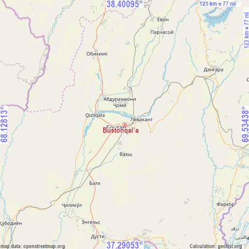
Bŭstonqal’a GPS coordinates[2]
37° 50' 52.188" North, 68° 49' 52.5" East
| Map corner | latitude | longitude |
|---|---|---|
| Upper-left | 38.40095°, | 68.12813° |
| Center: | 37.84783°, | 68.83125° |
| Lower-right: | 37.29053°, | 69.53438° |
| Map W x H: | 123.5×123.5 km | = 76.7×76.7mi |
| max Lat: | 40.99827° ⇑72.7% North |
| Bŭstonqal’a: | 37.84783° |
| min Lat: | ⇓27.3% South 36.72484° |
| min Long | Bŭstonqal’a | max Long |
| 67.60931° | 68.83125° | 73.96674° |
| W 30.7%⇐ | ⇒69.3% E |
Elevation
Elevation of Bŭstonqal’a is 442 m = 1450 ft, and this is 520.5 m = 1708 ft below average elevation for this country.
| Max E: |
3607 m = 11834 ft | 69.3% |
| Avg. | 962.5 m = 3158 ft | |
| Bŭstonqal’a | 442 m = 1450 ft | |
Min E: |
324 m = 1063 ft | 30.7% |
See also: Tajikistan elevation on elevation.city.
Geographical zone
Bŭstonqal’a is located in North temperate zone (between Tropic of Cancer and the Arctic Circle). Distance of this Northern Tropic circle is 1602.4 km =995.7 mi to South.| Distance of | km | miles | from Bŭstonqal’a |
|---|---|---|---|
| North Pole | 5798.8 | 3603.2 | to North |
| Arctic Circle | 3192.9 | 1984 | to North |
| Tropic Cancer | 1602.4 | 995.7 | to South |
| Equator | 4208.3 | 2614.9 | to South |


Nearby cities:
15 places around Bŭstonqal’a: (largest is in red/bold)
• Abdurahmoni Jomí
11.1 km =6.9 mi,  349°
349°
• Danghara
52.4 km =32.6 mi,  58°
58°
• Dŭstí
57.5 km =35.7 mi,  194°
194°
• Gharavŭtí
46 km =28.6 mi,  227°
227°
• Ismoili Somoní
9.4 km =5.8 mi,  196°
196°
• Jilikŭl
47.6 km =29.6 mi,  213°
213°
• Kirov
4 km =2.5 mi,  142°
142°
• Kolkhozobod
32.6 km =20.3 mi, 207°
• Moskovskiy
34.5 km =21.4 mi,  219°
219°
• Obikiik
37.6 km =23.4 mi,  337°
337°
• Orzu
32.2 km =20 mi,  181°
181°
• Qŭrghonteppa
4.6 km =2.9 mi,  250°
250°
• Sarband
8.4 km =5.2 mi,  71°
71°
• Vakhsh
14.8 km =9.2 mi, 178°
• Yovon
54.9 km =34.1 mi,  19°
19°
Sources, notices
• [Note1] Compared only with cities in Tajikistan existing in our database
• [Src1] Map data: © OpenStreetMap contributors (CC-BY-SA)
• [Src2] Other city data from geonames.org with taken over terms of usage.
• [Src3] Geographical zone / Annual Mean Temperature by Robert A. Rohde @ Wikipedia
