Yovon geodata
Yovon (Khatlon) is a seat of a second-order administrative division; located in Tajikistan in Asia/Dushanbe (GMT+5) time zone. With population of 17,471 people, there are 22 cities with bigger population in this country. Compared to other cities in Tajikistan, 60.2% of cities are located further ↑North; 60.2% of cities are located further →East and 59.1% of cities have higher elevation than Yovon. Note1


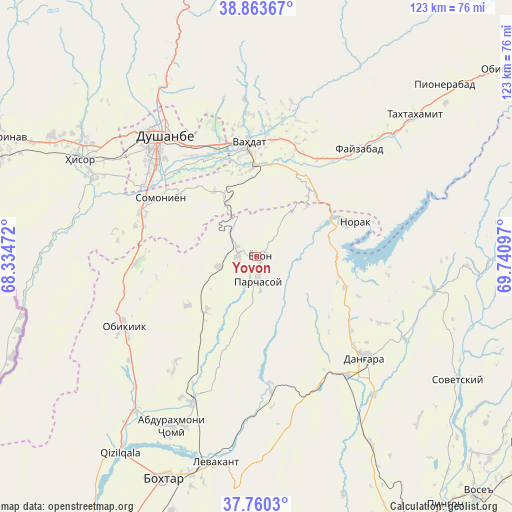
Yovon GPS coordinates[2]
38° 18' 50.688" North, 69° 2' 16.224" East
| Map corner | latitude | longitude |
|---|---|---|
| Upper-left | 38.86367°, | 68.33472° |
| Center: | 38.31408°, | 69.03784° |
| Lower-right: | 37.7603°, | 69.74097° |
| Map W x H: | 122.7×122.7 km | = 76.2×76.2mi |
| max Lat: | 40.99827° ⇑60.2% North |
| Yovon: | 38.31408° |
| min Lat: | ⇓39.8% South 36.72484° |
| min Long | Yovon | max Long |
| 67.60931° | 69.03784° | 73.96674° |
| W 39.8%⇐ | ⇒60.2% E |
Elevation
Elevation of Yovon is 654 m = 2146 ft, and this is 308.5 m = 1012 ft below average elevation for this country.
| Max E: |
3607 m = 11834 ft | 59.1% |
| Avg. | 962.5 m = 3158 ft | |
| Yovon | 654 m = 2146 ft | |
Min E: |
324 m = 1063 ft | 40.9% |
See also: Tajikistan elevation on elevation.city.
Geographical zone
Yovon is located in North temperate zone (between Tropic of Cancer and the Arctic Circle). Distance of this Northern Tropic circle is 1654.2 km =1027.9 mi to South.| Distance of | km | miles | from Yovon |
|---|---|---|---|
| North Pole | 5746.9 | 3571 | to North |
| Arctic Circle | 3141 | 1951.7 | to North |
| Tropic Cancer | 1654.2 | 1027.9 | to South |
| Equator | 4260.1 | 2647.1 | to South |


Nearby cities:
15 places around Yovon: (largest is in red/bold)
• Abdurahmoni Jomí
45.5 km =28.3 mi,  206°
206°
• Baljuvon
55.7 km =34.6 mi,  90°
90°
• Boshkengash
26.4 km =16.4 mi,  309°
309°
• Bŭstonqal’a
54.9 km =34.1 mi,  199°
199°
• Danghara
35.9 km =22.3 mi,  132°
132°
• Dushanbe
33.4 km =20.8 mi,  317°
317°
• Fayzobod
35.7 km =22.2 mi,  43°
43°
• Hisor
48.4 km =30.1 mi,  298°
298°
• Norak
26.2 km =16.3 mi,  71°
71°
• Obikiik
36.7 km =22.8 mi,  242°
242°
• Sarband
50.3 km =31.3 mi,  191°
191°
• Somoniyon
27 km =16.8 mi, 301°
• Sovet
56.6 km =35.2 mi,  121°
121°
• Vahdat
27 km =16.8 mi,  355°
355°
• Varzob
54.6 km =33.9 mi,  339°
339°
Sources, notices
• [Note1] Compared only with cities in Tajikistan existing in our database
• [Src1] Map data: © OpenStreetMap contributors (CC-BY-SA)
• [Src2] Other city data from geonames.org with taken over terms of usage.
• [Src3] Geographical zone / Annual Mean Temperature by Robert A. Rohde @ Wikipedia
