Abdurahmoni Jomí geodata
Abdurahmoni Jomí (Khatlon) is a seat of a second-order administrative division; located in Tajikistan in Asia/Dushanbe (GMT+5) time zone. With population of 9,943 people, there are 35 cities with bigger population in this country. Compared to other cities in Tajikistan, 68.2% of cities are located further ↑North; 73.9% of cities are located further →East and 76.1% of cities have higher elevation than Abdurahmoni Jomí. Note1


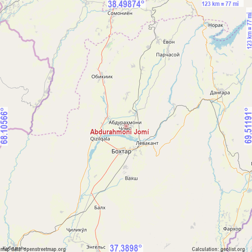
Abdurahmoni Jomí GPS coordinates[2]
37° 56' 46.896" North, 68° 48' 31.608" East
| Map corner | latitude | longitude |
|---|---|---|
| Upper-left | 38.49874°, | 68.10566° |
| Center: | 37.94636°, | 68.80878° |
| Lower-right: | 37.3898°, | 69.51191° |
| Map W x H: | 123.3×123.3 km | = 76.6×76.6mi |
| max Lat: | 40.99827° ⇑68.2% North |
| Abdurahmoni Jomí: | 37.94636° |
| min Lat: | ⇓31.8% South 36.72484° |
| min Long | Abdurahmoni Jom | max Long |
| 67.60931° | 68.80878° | 73.96674° |
| W 26.1%⇐ | ⇒73.9% E |
Elevation
Elevation of Abdurahmoni Jomí is 424 m = 1391 ft, and this is 538.5 m = 1767 ft below average elevation for this country.
| Max E: |
3607 m = 11834 ft | 76.1% |
| Avg. | 962.5 m = 3158 ft | |
| Abdurahmoni Jomí | 424 m = 1391 ft | |
Min E: |
324 m = 1063 ft | 23.9% |
See also: Tajikistan elevation on elevation.city.
Geographical zone
Abdurahmoni Jomí is located in North temperate zone (between Tropic of Cancer and the Arctic Circle). Distance of this Northern Tropic circle is 1613.3 km =1002.5 mi to South.| Distance of | km | miles | from Abdurahmoni Jomí |
|---|---|---|---|
| North Pole | 5787.8 | 3596.4 | to North |
| Arctic Circle | 3181.9 | 1977.1 | to North |
| Tropic Cancer | 1613.3 | 1002.5 | to South |
| Equator | 4219.2 | 2621.7 | to South |


Nearby cities:
15 places around Abdurahmoni Jomí: (largest is in red/bold)
• Bŭstonqal’a
11.1 km =6.9 mi,  169°
169°
• Danghara
49.4 km =30.7 mi,  70°
70°
• Gharavŭtí
52.8 km =32.8 mi,  217°
217°
• Ismoili Somoní
20 km =12.4 mi,  181°
181°
• Jilikŭl
56.1 km =34.9 mi,  205°
205°
• Kirov
14.8 km =9.2 mi,  162°
162°
• Kolkhozobod
41.9 km =26 mi,  198°
198°
• Moskovskiy
42.5 km =26.4 mi, 208°
• Obikiik
26.9 km =16.7 mi,  332°
332°
• Orzu
43.2 km =26.8 mi, 178°
• Qŭrghonteppa
12.7 km =7.9 mi,  190°
190°
• Sarband
13 km =8.1 mi,  129°
129°
• Somoniyon
55.2 km =34.3 mi,  356°
356°
• Vakhsh
25.8 km =16 mi, 174°
• Yovon
45.5 km =28.3 mi,  26°
26°
Sources, notices
• [Note1] Compared only with cities in Tajikistan existing in our database
• [Src1] Map data: © OpenStreetMap contributors (CC-BY-SA)
• [Src2] Other city data from geonames.org with taken over terms of usage.
• [Src3] Geographical zone / Annual Mean Temperature by Robert A. Rohde @ Wikipedia
