Çatalca geodata
Çatalca (Istanbul) is a populated place; located in Turkey in Europe/Istanbul (GMT+3) time zone. With population of 19,316 people, there are 339 cities with bigger population in this country. Compared to other cities in Turkey, 93% of cities are located further ↓South; 87.3% of cities are located further →East and 82.7% of cities have higher elevation than Çatalca. Note1


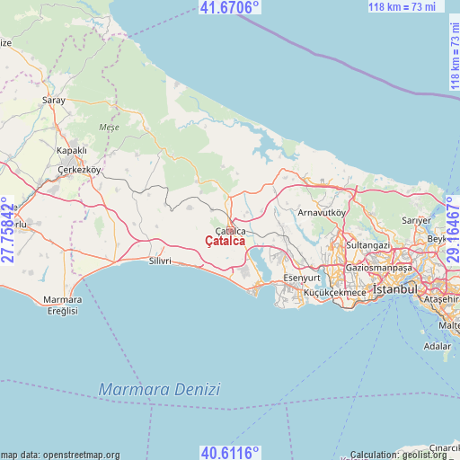
Çatalca GPS coordinates[2]
41° 8' 35.664" North, 28° 27' 41.544" East
| Map corner | latitude | longitude |
|---|---|---|
| Upper-left | 41.6706°, | 27.75842° |
| Center: | 41.14324°, | 28.46154° |
| Lower-right: | 40.6116°, | 29.16467° |
| Map W x H: | 117.7×117.7 km | = 73.1×73.1mi |
| max Lat: | 42.02683° ⇑7% North |
| Çatalca: | 41.14324° |
| min Lat: | ⇓93% South 35.9025° |
| min Long | Çatalca | max Long |
| 25.90902° | 28.46154° | 44.60099° |
| W 12.7%⇐ | ⇒87.3% E |
Elevation
Elevation of Çatalca is 88 m = 289 ft, and this is 629.4 m = 2065 ft below average elevation for this country.
| Max E: |
2682 m = 8799 ft | 82.7% |
| Avg. | 717.4 m = 2354 ft | |
| Çatalca | 88 m = 289 ft | |
Min E: |
0 m = 0 ft | 17.3% |
See also: Turkey elevation on elevation.city.
Geographical zone
Çatalca is located in North temperate zone (between Tropic of Cancer and the Arctic Circle). Distance of this Northern Tropic circle is 1968.8 km =1223.4 mi to South.| Distance of | km | miles | from Çatalca |
|---|---|---|---|
| North Pole | 5432.4 | 3375.5 | to North |
| Arctic Circle | 2826.5 | 1756.3 | to North |
| Tropic Cancer | 1968.8 | 1223.4 | to South |
| Equator | 4574.7 | 2842.6 | to South |


Nearby cities:
15 places around Çatalca: (largest is in red/bold)
• Boyalık
19.5 km =12.1 mi,  46°
46°
• Büyük Sinekli
22.7 km =14.1 mi,  293°
293°
• Büyükçekmece
17.1 km =10.6 mi,  142°
142°
• Celâliye
10.8 km =6.7 mi,  199°
199°
• Chekmejeh
15.9 km =9.9 mi,  156°
156°
• Esenyurt
22.2 km =13.8 mi,  125°
125°
• Gürpınar
21.1 km =13.1 mi, 142°
• Kavaklı
12.2 km =7.6 mi,  242°
242°
• Kumburgaz
13.7 km =8.5 mi,  173°
173°
• Mimarsinan
16.3 km =10.1 mi,  148°
148°
• Muratbey
5.8 km =3.6 mi, 153°
• Ortaköy
8.5 km =5.3 mi, 237°
• Selimpaşa
12.7 km =7.9 mi,  218°
218°
• Silivri
19.6 km =12.2 mi,  246°
246°
• Tepecik
14.7 km =9.1 mi, 149°
Sources, notices
• [Note1] Compared only with cities in Turkey existing in our database
• [Src1] Map data: © OpenStreetMap contributors (CC-BY-SA)
• [Src2] Other city data from geonames.org with taken over terms of usage.
• [Src3] Geographical zone / Annual Mean Temperature by Robert A. Rohde @ Wikipedia
