Kayatepe geodata
Kayatepe (Mardin) is a populated place; located in Turkey in Europe/Istanbul (GMT+3) time zone. With population of 750 people, there are 1180 cities with bigger population in this country. Compared to other cities in Turkey, 74.2% of cities are located further ↑North; 80.6% of cities are located further ←West and 76.4% of cities have lower elevation than Kayatepe. Note1


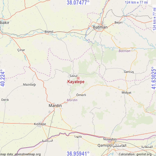
Kayatepe GPS coordinates[2]
37° 31' 9.012" North, 40° 55' 37.632" East
| Map corner | latitude | longitude |
|---|---|---|
| Upper-left | 38.07477°, | 40.224° |
| Center: | 37.51917°, | 40.92712° |
| Lower-right: | 36.95941°, | 41.63025° |
| Map W x H: | 124×124 km | = 77.1×77.1mi |
| max Lat: | 42.02683° ⇑74.2% North |
| Kayatepe: | 37.51917° |
| min Lat: | ⇓25.8% South 35.9025° |
| min Long | Kayatepe | max Long |
| 25.90902° | 40.92712° | 44.60099° |
| W 80.6%⇐ | ⇒19.4% E |
Elevation
Elevation of Kayatepe is 1128 m = 3701 ft, and this is 410.6 m = 1347 ft above average elevation for this country.
| Max E: |
2682 m = 8799 ft | 23.6% |
| Kayatepe | 1128 m 3701 ft | |
| Avg. | 717.4 m = 2354 ft | |
Min E: |
0 m = 0 ft | 76.4% |
See also: Turkey elevation on elevation.city.
Geographical zone
Kayatepe is located in North temperate zone (between Tropic of Cancer and the Arctic Circle). Distance of this Northern Tropic circle is 1565.8 km =972.9 mi to South.| Distance of | km | miles | from Kayatepe |
|---|---|---|---|
| North Pole | 5835.3 | 3625.9 | to North |
| Arctic Circle | 3229.4 | 2006.7 | to North |
| Tropic Cancer | 1565.8 | 972.9 | to South |
| Equator | 4171.7 | 2592.2 | to South |


Nearby cities:
15 places around Kayatepe: (largest is in red/bold)
• Aran
17.7 km =11 mi,  243°
243°
• Avine
18.2 km =11.3 mi,  289°
289°
• Başkavak
6.1 km =3.8 mi,  325°
325°
• Dereyanı
11.8 km =7.3 mi,  209°
209°
• Evkuran
16 km =9.9 mi,  11°
11°
• Pınardere
9.7 km =6 mi, 237°
• Reshidi
4.5 km =2.8 mi,  126°
126°
• Savur
4.6 km =2.9 mi, 292°
• Soylu
17.6 km =10.9 mi, 326°
• Teffi
15.5 km =9.6 mi,  73°
73°
• Tokluca
12.1 km =7.5 mi,  53°
53°
• Yenilmez
5.7 km =3.5 mi,  101°
101°
• Yeşilalan
14.2 km =8.8 mi, 242°
• Çınaraltı
16.1 km =10 mi,  201°
201°
• Ömerli
13.6 km =8.5 mi,  169°
169°
Sources, notices
• [Note1] Compared only with cities in Turkey existing in our database
• [Src1] Map data: © OpenStreetMap contributors (CC-BY-SA)
• [Src2] Other city data from geonames.org with taken over terms of usage.
• [Src3] Geographical zone / Annual Mean Temperature by Robert A. Rohde @ Wikipedia
