Seyitgazi geodata
Seyitgazi (Eskişehir) is a seat of a second-order administrative division; located in Turkey in Europe/Istanbul (GMT+3) time zone. With population of 3,284 people, there are 837 cities with bigger population in this country. Compared to other cities in Turkey, 60.5% of cities are located further ↓South; 71.9% of cities are located further →East and 66.8% of cities have lower elevation than Seyitgazi. Note1


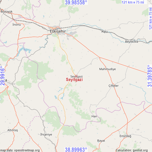
Seyitgazi GPS coordinates[2]
39° 26' 40.992" North, 30° 41' 40.992" East
| Map corner | latitude | longitude |
|---|---|---|
| Upper-left | 39.98558°, | 29.9916° |
| Center: | 39.44472°, | 30.69472° |
| Lower-right: | 38.89963°, | 31.39785° |
| Map W x H: | 120.7×120.7 km | = 75×75mi |
| max Lat: | 42.02683° ⇑39.5% North |
| Seyitgazi: | 39.44472° |
| min Lat: | ⇓60.5% South 35.9025° |
| min Long | Seyitgazi | max Long |
| 25.90902° | 30.69472° | 44.60099° |
| W 28.1%⇐ | ⇒71.9% E |
Elevation
Elevation of Seyitgazi is 983 m = 3225 ft, and this is 265.6 m = 871 ft above average elevation for this country.
| Max E: |
2682 m = 8799 ft | 33.2% |
| Seyitgazi | 983 m 3225 ft | |
| Avg. | 717.4 m = 2354 ft | |
Min E: |
0 m = 0 ft | 66.8% |
See also: Turkey elevation on elevation.city.
Geographical zone
Seyitgazi is located in North temperate zone (between Tropic of Cancer and the Arctic Circle). Distance of this Northern Tropic circle is 1779.9 km =1106 mi to South.| Distance of | km | miles | from Seyitgazi |
|---|---|---|---|
| North Pole | 5621.2 | 3492.9 | to North |
| Arctic Circle | 3015.3 | 1873.6 | to North |
| Tropic Cancer | 1779.9 | 1106 | to South |
| Equator | 4385.8 | 2725.2 | to South |


Nearby cities:
15 places around Seyitgazi: (largest is in red/bold)
• Alpu
42.7 km =26.5 mi,  32°
32°
• Beylikova
51.4 km =31.9 mi,  58°
58°
• Bozan
51.7 km =32.1 mi,  42°
42°
• Eskişehir
39.8 km =24.7 mi,  337°
337°
• Han
34.8 km =21.6 mi,  155°
155°
• Hekimdağ
52.8 km =32.8 mi,  347°
347°
• Kaymaz
42.4 km =26.3 mi,  79°
79°
• Kırka
23.4 km =14.5 mi,  218°
218°
• Mahmudiye
25.8 km =16 mi, 76°
• Odunpazarı
38.5 km =23.9 mi, 339°
• Sabuncu
45.4 km =28.2 mi,  286°
286°
• Sevinç
37.3 km =23.2 mi,  359°
359°
• Tepebaşı
43.2 km =26.8 mi, 340°
• Çifteler
30.4 km =18.9 mi,  103°
103°
• İhsaniye
52.1 km =32.4 mi,  207°
207°
Sources, notices
• [Note1] Compared only with cities in Turkey existing in our database
• [Src1] Map data: © OpenStreetMap contributors (CC-BY-SA)
• [Src2] Other city data from geonames.org with taken over terms of usage.
• [Src3] Geographical zone / Annual Mean Temperature by Robert A. Rohde @ Wikipedia
