Şaphane geodata
Şaphane (Kütahya) is a seat of a second-order administrative division; located in Turkey in Europe/Istanbul (GMT+3) time zone. With population of 5,085 people, there are 720 cities with bigger population in this country. Compared to other cities in Turkey, 55% of cities are located further ↓South; 81.7% of cities are located further →East and 67.6% of cities have lower elevation than Şaphane. Note1


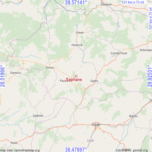
Şaphane GPS coordinates[2]
39° 1' 38.28" North, 29° 13' 19.848" East
| Map corner | latitude | longitude |
|---|---|---|
| Upper-left | 39.57141°, | 28.51906° |
| Center: | 39.0273°, | 29.22218° |
| Lower-right: | 38.47897°, | 29.92531° |
| Map W x H: | 121.5×121.5 km | = 75.5×75.5mi |
| max Lat: | 42.02683° ⇑45% North |
| Şaphane: | 39.0273° |
| min Lat: | ⇓55% South 35.9025° |
| min Long | Şaphane | max Long |
| 25.90902° | 29.22218° | 44.60099° |
| W 18.3%⇐ | ⇒81.7% E |
Elevation
Elevation of Şaphane is 994 m = 3261 ft, and this is 276.6 m = 907 ft above average elevation for this country.
| Max E: |
2682 m = 8799 ft | 32.4% |
| Şaphane | 994 m 3261 ft | |
| Avg. | 717.4 m = 2354 ft | |
Min E: |
0 m = 0 ft | 67.6% |
See also: Turkey elevation on elevation.city.
Geographical zone
Şaphane is located in North temperate zone (between Tropic of Cancer and the Arctic Circle). Distance of this Northern Tropic circle is 1733.5 km =1077.1 mi to South.| Distance of | km | miles | from Şaphane |
|---|---|---|---|
| North Pole | 5667.6 | 3521.7 | to North |
| Arctic Circle | 3061.7 | 1902.5 | to North |
| Tropic Cancer | 1733.5 | 1077.1 | to South |
| Equator | 4339.4 | 2696.4 | to South |


Nearby cities:
15 places around Şaphane: (largest is in red/bold)
• Bölme
47.1 km =29.3 mi,  163°
163°
• Dağardı
48.9 km =30.4 mi,  336°
336°
• Demirci
48.7 km =30.3 mi,  272°
272°
• Emet
35.2 km =21.9 mi,  5°
5°
• Gediz
15.1 km =9.4 mi,  104°
104°
• Güre
42.1 km =26.2 mi,  186°
186°
• Hisarcık
24.8 km =15.4 mi,  1°
1°
• Pazarlar
9.1 km =5.7 mi,  246°
246°
• Selendi
43.9 km =27.3 mi,  224°
224°
• Simav
22.2 km =13.8 mi,  287°
287°
• Uşak
42.4 km =26.3 mi, 157°
• Yarbasan
36 km =22.4 mi,  263°
263°
• Çavdarhisar
38.9 km =24.2 mi,  61°
61°
• Örencik
38.1 km =23.7 mi,  46°
46°
• İlyaslı
47.1 km =29.3 mi,  182°
182°
Sources, notices
• [Note1] Compared only with cities in Turkey existing in our database
• [Src1] Map data: © OpenStreetMap contributors (CC-BY-SA)
• [Src2] Other city data from geonames.org with taken over terms of usage.
• [Src3] Geographical zone / Annual Mean Temperature by Robert A. Rohde @ Wikipedia
